

General Survey Services
- Topography Survey
- Stake Out Survey
- Underground Utility Detection Survey(GPR and Cable Detector)
- 3D Laser Scanning
- Mobile Mapping
- Uav Drone/Aerial Survey
- Monitoring Survey
- Control Point Survey
- Architectural/Structural /Mep Asbuilt Survey
- Hydrographic Survey
- Offshore/Onshore Survey Services
- Rebar Scanning and Concrete Imaging
- Dilapidation Survey
- Quantity And Volumetric Survey
- Traffic Survey
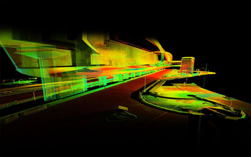
Accurate Survey Engineering provides advanced mobile mapping services in Dubai and across the UAE for infrastructure, transportation, utility, industrial, and urban development projects. Our mobile mapping solutions use high-precision LiDAR systems, GPS/GNSS positioning, 3D laser scanning, GIS technologies, and panoramic imaging systems to capture accurate geospatial data efficiently across large project environments.
As one of the trusted mobile mapping companies in UAE, we deliver reliable mobile mapping solutions for road corridors, highways, railways, smart city developments, utility networks, infrastructure planning, and asset management projects.
Mobile mapping is a geospatial data collection method that uses vehicle-mounted survey systems to capture accurate spatial information while traveling through roads, transportation corridors, industrial sites, and urban environments.
Modern mobile mapping systems combine:
- Mobile LiDAR scanning
- GPS/GNSS positioning
- Inertial Measurement Units (IMU)
- 360-degree panoramic imaging
- GIS mapping technologies
- Point cloud processing
These technologies work together to generate highly detailed 3D geospatial data for engineering, construction, infrastructure, and transportation projects.
Mobile mapping helps survey engineers quickly collect accurate information about:
- Roads and highways
- Utility corridors
- Bridges and tunnels
- Railway infrastructure
- Urban environments
- Industrial facilities
- Transportation networks
- Existing infrastructure assets
How Mobile Mapping Works?
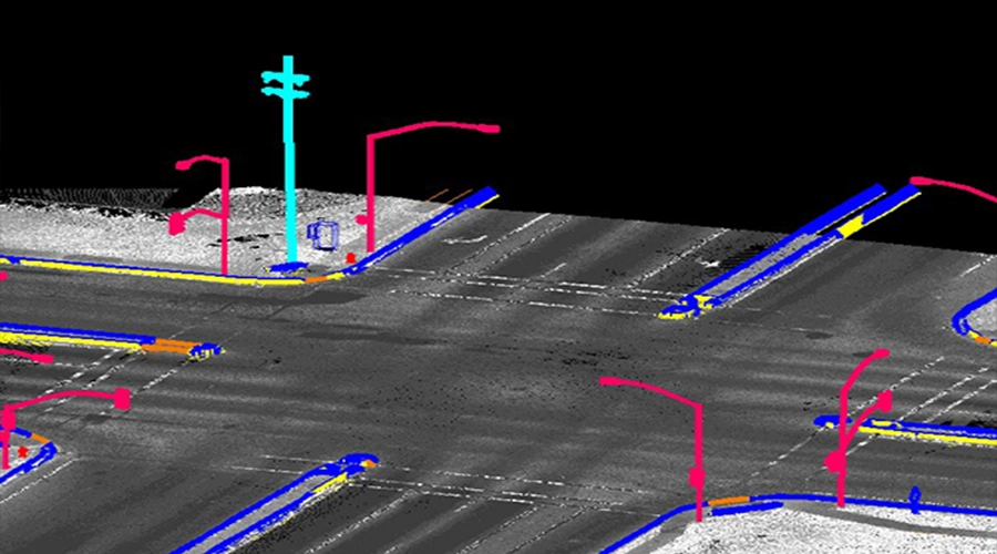
Vehicle-Mounted Survey Systems
Mobile mapping systems are installed on specially equipped survey vehicles that travel through project areas while collecting geospatial data continuously.
LiDAR Data Collection
LiDAR sensors emit laser pulses to measure distances and capture millions of accurate spatial points that form highly detailed point cloud datasets.
GPS/GNSS Positioning
GPS and GNSS systems provide accurate positioning coordinates to ensure precise geospatial alignment of collected survey data.
IMU Integration
Inertial Measurement Units (IMU) help maintain data accuracy by tracking vehicle movement, orientation, and motion during the survey process.
360° Panoramic Imaging
Panoramic cameras capture high-resolution imagery of roads, infrastructure, utilities, and surrounding environments for visual analysis and mapping.
Point Cloud Processing
Collected LiDAR and imaging data are processed into highly accurate 3D point cloud models for engineering analysis and infrastructure planning.
GIS and CAD Deliverables
Final mapping deliverables are processed into GIS datasets, CAD drawings, digital terrain models, and infrastructure mapping solutions.
Types of Mobile Mapping Services
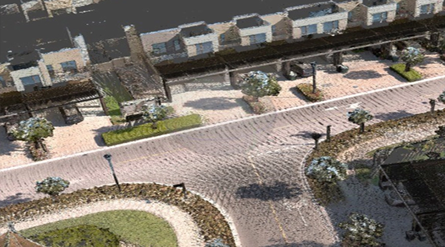
Road Corridor Mobile Mapping
Road corridor mobile mapping services help capture highly accurate data for highways, roads, transportation networks, drainage systems, and infrastructure corridors.
These surveys support:
- Highway planning
- Road widening projects
- Transportation infrastructure
- Corridor analysis
- Road asset mapping
- Utility alignment planning
Mobile mapping significantly improves efficiency for large roadway survey projects across UAE transportation networks.
Railway Mobile Mapping
Railway mobile mapping solutions help survey engineers collect accurate rail infrastructure data for railway alignment analysis, corridor mapping, and transportation planning.
Railway mobile mapping supports:
- Rail corridor analysis
- Track alignment surveys
- Railway asset management
- Infrastructure monitoring
- Transportation engineering
Urban Infrastructure Mapping
Urban infrastructure mapping services support smart city developments and municipal infrastructure management projects throughout Dubai and the UAE.
These services help map:
- Urban roads
- Utility infrastructure
- Municipal assets
- Street furniture
- Public infrastructure
- Smart city systems
Accurate urban mapping data supports efficient infrastructure planning and maintenance.
Utility and Industrial Corridor Mapping
Utility and industrial corridor mapping services help identify and document utility infrastructure and industrial environments.
These surveys support:
- Pipeline corridors
- Oil and gas facilities
- Utility infrastructure
- Electrical networks
- Telecom corridors
- Industrial site mapping
Asset Mapping Services
Asset mapping solutions help organizations create accurate digital inventories of infrastructure assets and utilities.
Asset mapping may include:
- Road signs
- Street lighting
- Utility poles
- Drainage structures
- Safety barriers
- Traffic infrastructure
These mapping solutions improve infrastructure management and maintenance planning.
Google Updation Survey Services for RTA and Road Infrastructure
Accurate Survey Engineering provides Google updation survey services for road and transportation infrastructure projects across Dubai and the UAE. Our survey engineers collect accurate geospatial and mapping data to support the integration of newly developed roads, transportation corridors, and infrastructure into digital navigation platforms such as Google Maps.
Our Google updation survey services support:
- Accurate road navigation
- Newly developed road updates
- Transportation route integration
- Infrastructure mapping
- GIS data collection
- Smart transportation systems
- Public transport route optimization
These services help improve navigation accuracy for drivers, logistics providers, transportation authorities, and public infrastructure systems.
3D Mobile Mapping Services in UAE
Our 3D mobile mapping services use advanced mobile LiDAR technology and geospatial survey systems to generate highly accurate three-dimensional models of roads, infrastructure, transportation corridors, and urban environments.
3D mobile mapping supports:
- Urban planning
- Smart city development
- Infrastructure design
- Transportation engineering
- BIM workflows
- Digital twin creation
- Utility planning
- Environmental analysis
The generated 3D point cloud models deliver detailed spatial data that helps engineers and planners perform accurate analysis and visualize projects effectively.
Road and Underpass Settlement Monitoring Services
Our monitoring services for roads and underpasses focus on tracking settlement to maintain the safety and longevity of these structures. Services include:
Road and underpass settlement monitoring services help track structural movement and infrastructure settlement conditions to improve long-term transportation safety and infrastructure reliability.
Our settlement monitoring services support:
- Road infrastructure monitoring
- Underpass settlement analysis
- Structural movement detection
- Deformation monitoring
- Infrastructure safety assessments
- Preventative maintenance planning
Settlement Data Monitoring
We provide accurate monitoring data to track structural movement, settlement conditions, and infrastructure performance over time.
Preventative Infrastructure Analysis
Continuous monitoring helps engineers identify early-stage infrastructure movement before major structural issues occur, reducing maintenance costs and improving infrastructure lifespan.
Transportation Infrastructure Safety
Settlement monitoring solutions help maintain the stability and safety of highways, underpasses, tunnels, bridges, and transportation corridors throughout the UAE.
Applications of Mobile Mapping in UAE
Mobile mapping services are widely used across multiple industries in Dubai and the UAE.
- Transportation Infrastructure: Mobile mapping supports road, highway, railway, and transportation corridor planning projects.
- Smart City Developments: Geospatial mapping data supports smart city infrastructure, urban planning, and municipal asset management.
- Utility and Infrastructure Management: Mobile mapping helps identify and manage utility infrastructure and underground networks efficiently.
- Engineering and Construction Projects: Engineering consultants and contractors use mobile mapping data for project planning, analysis, and infrastructure development.
Benefits of Mobile Mapping Services
- Faster Data Collection: Mobile mapping systems capture large-scale geospatial data quickly and efficiently.
- Improved Survey Safety: Data can be collected without interrupting traffic flow or exposing survey teams to hazardous environments.
- High Accuracy: Advanced LiDAR and GPS technologies deliver highly accurate mapping and positioning data.
- Large-Scale Coverage: Mobile mapping is ideal for surveying highways, transportation corridors, railways, and urban infrastructure.
- Reduced Project Costs: Efficient data collection and processing help reduce overall survey and project costs.
Mobile Mapping vs Traditional Surveying
| Mobile Mapping | Traditional Surveying |
|---|---|
| Fast large-scale data collection | Slower field survey process |
| High-density point cloud data | Limited data density |
| Reduced traffic disruptions | More road closures required |
| Improved survey safety | Increased field exposure |
| Ideal for infrastructure corridors | Suitable for smaller survey areas |
Mobile Mapping Deliverables
Our mobile mapping services provide:
- Point cloud datasets
- GIS mapping data
- CAD drawings
- 3D infrastructure models
- Asset inventories
- Corridor mapping data
- Orthophotos
- Digital terrain models
- Infrastructure analysis reports
Why Choose Accurate Survey Engineering?
Accurate Survey Engineering provides reliable mobile mapping services across Dubai and the UAE using advanced geospatial technologies and industry-standard survey workflows.
Why clients choose us:
- Experienced survey engineers
- Advanced mobile LiDAR systems
- Accurate geospatial deliverables
- Modern survey technologies
- Fast project turnaround
- Infrastructure mapping expertise
- UAE project experience
- Reliable engineering support
We deliver accurate and efficient mobile mapping solutions tailored to infrastructure, transportation, utility, and urban development projects.
Frequently Asked Questions
Looking for Professional Mobile Mapping Services in the UAE?
Accurate Survey Engineering provides advanced mobile mapping solutions across Dubai, Abu Dhabi, Sharjah, and throughout the UAE for transportation, infrastructure, utility, and engineering projects.
Contact our expert survey engineers today for reliable mobile mapping, LiDAR scanning, GIS mapping, infrastructure analysis, and 3D geospatial survey solutions in UAE.
Need help with this service? Contact our team today.
Contact Us