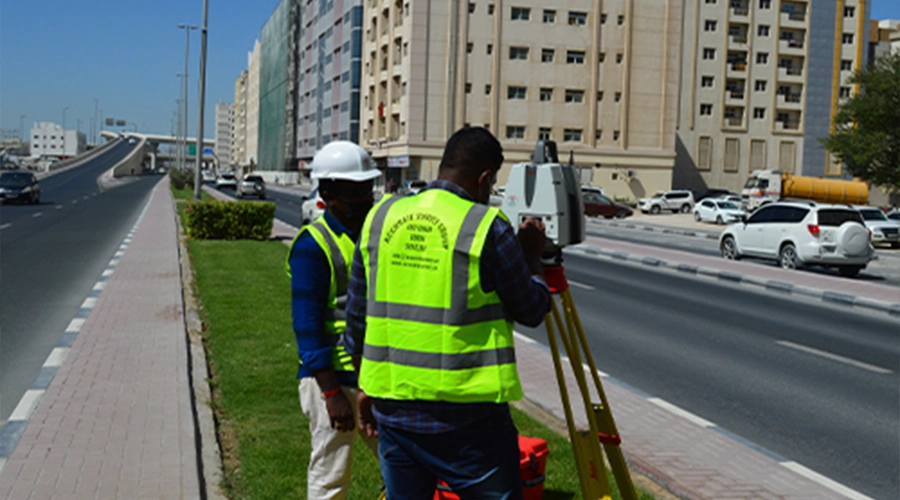
- Topography Survey
- Stake Out Survey
- Underground Utility Detection Survey(GPR and Cable Detector)
- 3D Laser Scanning
- Mobile Mapping
- Uav Drone/Aerial Survey
- Monitoring Survey
- Control Point Survey
- Architectural/Structural /Mep Asbuilt Survey
- Hydrographic Survey
- Offshore/Onshore Survey Services
- Rebar Scanning and Concrete Imaging
- Dilapidation Survey
- Quantity And Volumetric Survey
- Traffic Survey
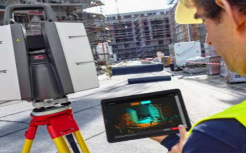
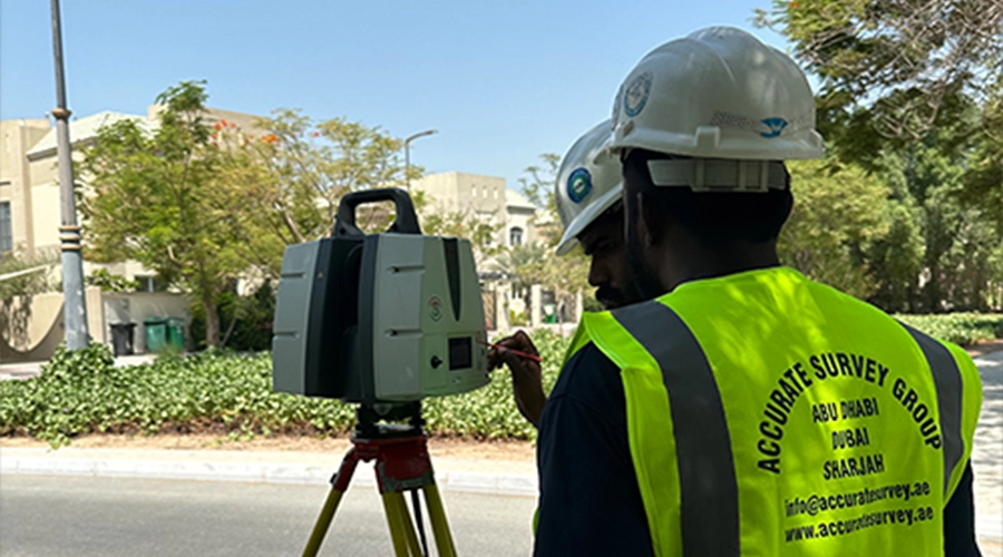
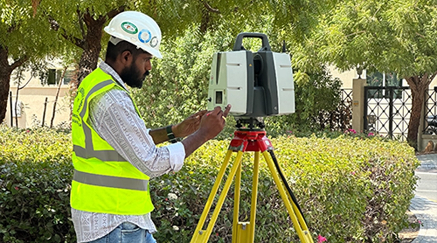
Accurate Survey Engineering provides professional 3D laser scanning services across Dubai, Abu Dhabi, Sharjah, and the UAE. Using Leica ScanStation P40 technology, we capture one million measurement points per second at up to 270 m range, producing millimetre-accurate point clouds for as-built surveys, BIM models, construction, oil and gas, heritage, and infrastructure projects.
Whether you are working on a high-rise construction project in Dubai, an infrastructure corridor in Abu Dhabi, an oil and gas facility in Sharjah, or a heritage structure anywhere in the Emirates, our certified surveyors deliver fast, non-contact, millimetre-accurate 3D data that integrates directly into your design and engineering workflows.
What is 3D Laser Scanning and How Does It Work?
3D laser scanning, also called LiDAR scanning or high-definition surveying, is a non-contact measurement technology that captures the exact geometry of any structure, terrain, or object in three dimensions. A laser scanner fires rapid pulses of light at a surface and measures the time each pulse takes to return. By combining millions of these measurements, the scanner builds a dense, three-dimensional point cloud: a precise digital replica of the scanned environment.
Unlike traditional surveying, which captures individual measurements one at a time, a 3D laser scanner acquires up to one million points per second with sub-millimetre accuracy. This makes it the preferred method for any project where speed, completeness, and data richness are critical from a single-floor office as-built in Dubai to a multi-site pipeline inspection across the UAE.
What Equipment Does Accurate Survey Use for 3D Laser Scanning in UAE?
At Accurate Survey, we deploy the Leica ScanStation P30/P40; widely recognised as one of the most accurate terrestrial laser scanners available globally. Key technical specifications:
- Scan speed: up to 1,000,000 points per second
- Maximum range: 270 metres from a single scanner station
- Angular accuracy: 8 arc seconds
- 3D position accuracy: 3 mm at 50 m range
- High-Dynamic Range (HDR) colour imaging for photorealistic point clouds
- Survey-grade dual-axis compensation for consistent data quality on uneven terrain
Field data acquisition is managed through Leica’s Cyclone FIELD 360 software, which links the scanner directly to our office processing platform. Final registration, quality control, and deliverable production are handled in Cyclone REGISTER 360 ensuring that every scan station is automatically registered to produce a single, unified, geo-referenced point cloud.
Which Industries Use 3d Laser Scanning in the UAE?
Our 3D laser scanning services are deployed across a broad range of industries and project types throughout Dubai, Abu Dhabi, Sharjah, and the wider Emirates:
Construction and Infrastructure
We support contractors, project managers, and engineers with as-built surveys, progress monitoring, clash detection, and quantity verification on commercial, residential, and infrastructure projects across Dubai and Abu Dhabi. Accurate point clouds reduce rework by verifying that constructed elements match design intent before the next phase begins.
Scan to BIM for Buildings
Existing buildings and structures are scanned using 3D laser scanners to capture precise structural data, which is then converted into detailed BIM models and CAD drawings. This workflow, known as Scan to BIM, transforms real-world conditions into intelligent digital models in Revit, AutoCAD, or IFC formats.
This is essential for fit-out contractors, facility managers, and architects handling renovation or extension projects, especially where original drawings are unavailable or outdated.
Oil, Gas, and Industrial Facilities
We carry out 3D laser scanning of refineries, petrochemical plants, pipelines, and offshore/onshore oil and gas facilities across the UAE. Point cloud data enables accurate plant layout models, as-built piping documentation, and clash checks for plant modification projects without shutting down operations.
Heritage and Cultural Site Documentation
The UAE’s rich cultural heritage from historic forts and mosques to traditional souqs and archaeological sites requires non-destructive, high-accuracy documentation. 3D laser scanning captures every architectural detail for preservation, restoration planning, and archival records without any contact with the structure.
MEP and As-built Surveys
Mechanical, electrical, and plumbing (MEP) coordination is critical in complex buildings. We scan ceiling voids, risers, plant rooms, and occupied floors to produce accurate as-built drawings and 3D models that serve as the single source of truth for maintenance, retrofitting, and renovation teams.
Structural Condition Assessment and Monitoring
Comparing scan data captured at different intervals reveals deformation, settlement, or structural changes with millimetre precision. This is widely used for bridge monitoring, dam inspections, high-rise structural checks, and heritage building condition assessments across the UAE.
Urban Development and Master Planning
Large-area terrestrial and aerial LiDAR scanning produces accurate topographic models of development sites, coastal areas, and urban corridors providing planners, developers, and government authorities with the precise elevation and surface data needed for master planning and infrastructure design.
How Does the 3D Laser Scanning Process Work?
We follow a structured, quality-assured five-step workflow from the first site visit to final deliverable handover:
- Step 1: Site assessment and planning: We review project drawings, define the scan coverage area, identify scanner positions, and agree on deliverable formats and coordinate systems with your team before mobilisation.
- Step 2: Field scanning: Our certified surveyors deploy Leica ScanStation units across the site, capturing overlapping scans from multiple stations to ensure full coverage with no data gaps.
- Step 3: Registration and quality control: Scan stations are automatically registered in Cyclone REGISTER 360. Each registration is checked for accuracy, and any problem areas are rescanned before we leave the site.
- Step 4: Point cloud processing: The registered point cloud is cleaned, colourised with HDR imagery, and geo-referenced to UAE coordinate systems where required.
- Step 5: Deliverable production and handover: We extract the agreed deliverables, CAD drawings, BIM models, orthophotos, reports, or raw point cloud files and hand them over in your preferred format with a QA sign-off sheet.
How 3D Laser Scanning Supports Scan to BIM
3D laser scanning plays a critical role in Scan to BIM by capturing accurate structural data of buildings and infrastructure. The collected point cloud data is processed and converted into BIM models and CAD drawings, ensuring that all architectural, structural, and MEP elements are accurately represented.
This process helps project teams:
- Eliminate errors from outdated drawings
- Improve design accuracy and coordination
- Support renovation, retrofitting, and expansion projects
- Create reliable digital models for long-term asset management
What are the Applications of 3D Laser Scanning?
3D laser scanning services are widely used across industries in the UAE to capture highly accurate spatial data and convert real-world environments into precise digital models. These applications support planning, design, inspection, and asset management with improved efficiency and reduced errors.
Key Applications of 3D Laser Scanning
- As-Built Documentation: Creation of accurate as-built drawings of buildings, infrastructure, and industrial facilities using real-time measurements.
- Scan to BIM (Building Information Modeling): High-accuracy point cloud data captured through 3D laser scanning is converted into detailed BIM models and CAD drawings, representing the exact structural condition of buildings. This supports design, renovation, clash detection, and facility management workflows.
- Construction Progress Monitoring: Regular site scanning to track project progress, compare with design models, and identify deviations early.
- Industrial Plant & Facility Management: 3D laser scanning helps document intricate industrial setups such as oil & gas facilities and manufacturing units, enabling efficient maintenance planning, system upgrades, and accurate identification of potential conflicts within existing structures.
- Structural Inspection & Quality Control: Laser scanning technology is used to assess structural integrity by identifying distortions, alignment issues, and possible defects, ensuring that projects meet safety requirements and engineering specifications.
- Heritage & Architectural Preservation: Digital documentation of historical buildings and cultural sites for restoration and conservation.
- Topographic & Land Surveying: High-accuracy terrain mapping, contour generation, and land development planning.
- Volume & Quantity Calculations: Accurate measurement of stockpiles, excavation volumes, and materials in construction and mining projects.
Why These Applications Matter?
- Improves accuracy and reduces human error
- Saves time and project costs
- Enhances safety in complex environments
- Supports better decision-making with reliable data
What are the Benefits of 3D Laser Scanning Service?
3D laser scanning provides highly accurate, fast, and reliable data capture, making it an essential solution for modern surveying, construction, and industrial projects in the UAE.
Core Benefits of 3D Laser Scanning
- High Accuracy and Precision: Captures millimeter-level measurements, ensuring reliable data for design, engineering, and analysis.
- Faster Data Collection: Scans large and complex areas quickly compared to traditional surveying methods, saving valuable project time.
- Reduced Human Error: Automated data capture minimizes manual measurement errors and improves overall data reliability.
- Improved Project Efficiency: Accurate data helps reduce rework, delays, and costly design modifications during project execution.
- Enhanced Safety: Enables remote data collection in hazardous or hard-to-reach environments, reducing risks for survey teams.
- Comprehensive Data Capture: Records millions of data points (point clouds), providing a complete and detailed representation of the site.
- Seamless Integration with BIM & CAD: Easily converts scan data into 2D drawings and 3D models for better planning, visualization, and collaboration.
- Cost Savings in the Long Run: Minimizes errors, rework, and project delays, ultimately reducing overall project costs.
- Supports Complex and Large-Scale Projects: Ideal for infrastructure, industrial plants, and high-rise developments requiring detailed and scalable data.
Why choose Accurate Survey for 3D laser scanning in UAE?
Choosing the right surveying partner is critical for achieving accurate, reliable, and timely results. Accurate Survey Engineering combines advanced technology, industry expertise, and a client-focused approach to deliver high-quality 3D laser scanning services across the UAE.
- Advanced Scanning Technology: Utilizes industry-leading equipment such as Leica laser scanners and advanced processing software to ensure high-precision data capture.
- Experienced & Skilled Survey Team: A team of qualified professionals with hands-on experience in handling complex projects across construction, infrastructure, and industrial sectors.
- High Accuracy & Reliable Data: Delivers millimeter-level accuracy, ensuring dependable results for design, planning, and analysis.
- Fast Turnaround Time: Efficient workflows and modern tools enable quick data collection and processing, helping you meet tight project deadlines.
- Comprehensive Service Offering: From site scanning and point cloud processing to Scan-to-BIM and CAD deliverables, all services are handled under one roof.
- Customized Solutions for Every Project: Tailored scanning solutions to meet specific project requirements, whether it’s a small site or a large-scale industrial facility.
- Strong Presence Across UAE: Proven experience working on diverse projects throughout the UAE, ensuring local expertise and compliance with regional standards.
- Cost-Effective & Value-Driven Services: Optimized processes reduce rework and project delays, helping clients save time and costs in the long run.
- Commitment to Quality & Client Satisfaction: Focus on delivering accurate results, clear communication, and reliable support throughout the project lifecycle.
Frequently Asked Questions
Need help with this service? Contact our team today.
Contact Us