

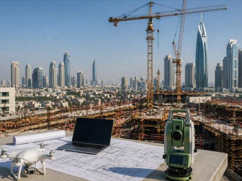
Dubai’s construction sector involves complex building, infrastructure and development projects where accurate site information is essential for keeping work on schedule. Surveying provides the spatial data required for planning, design, setting out and construction coordination.
However, surveying problems do not always result from measurement errors alone. Delays can also occur when the survey scope is unclear, information is not properly coordinated, site changes are not communicated, or survey data is not verified at the right stage.
Even when a project has a competent survey team, avoidable gaps in the surveying workflow can lead to rework, design adjustments, additional site visits and interruptions to construction activities.
Here are seven common surveying mistakes that can contribute to construction delays in Dubai and practical ways to avoid them.
Table of Contents
Toggle1. Starting Construction Without Confirming Current Site Conditions
One of the first mistakes is proceeding with design or construction using information that does not accurately represent the current site.
Existing conditions can change because of previous construction, excavation, filling, utility modifications, road works or other developments. Old drawings may therefore not fully represent what is currently present on the ground.
How this can cause delays
Outdated site information can result in:
- Incorrect design assumptions
- Unexpected ground conditions
- Conflicts with existing structures
- Additional survey requirements
- Design revisions during construction
How to avoid it
Conduct an appropriate site survey during the planning stage and ensure that the information being used by the design and construction teams reflects current site conditions.
2. Choosing a Survey Method That Does Not Match the Project
Different construction projects require different types of survey information. A method suitable for a small development may not provide sufficient coverage or detail for a large infrastructure or complex industrial project.
For example, projects may require combinations of topographic surveying, construction layout, utility detection, 3D laser scanning, UAV mapping or other specialist techniques.
How can this cause delays
Using an unsuitable approach may result in:
- Missing site information
- Insufficient detail
- Additional fieldwork
- Re-surveying
- Delays in design or construction decisions
How to avoid it
Define the project’s survey requirements before fieldwork begins and select the technology and methodology according to the site, project scale and required outputs.
3. Not Establishing Reliable Survey Control
Construction teams depend on consistent coordinates, reference points and elevations when transferring design information to the physical site.
If survey control is inconsistent or poorly established, different teams may work from different reference information.
How can this cause delays
This can lead to:
- Positioning discrepancies
- Alignment problems
- Incorrect setting out
- Rechecking of survey points
- Rework during construction
How to avoid it
Establish appropriate survey control and ensure that project teams work from consistent coordinate and elevation references throughout the construction process.
4. Failing to Coordinate Survey Data With Design Information
Survey data does not exist independently from the project design. Architects, engineers, BIM teams and contractors rely on survey information to develop and execute their work.
Problems can occur when survey data is delivered in a format, coordinate system or level of detail that does not align with the project’s design requirements.
How can this cause delays
Poor coordination may result in:
- Design conflicts
- Incorrect positioning
- Repeated data requests
- Additional processing
- Delays between design and site teams
How to avoid it
Agree on required formats, coordinate systems, levels of detail and deliverables before the survey begins. Survey information should be prepared so it can be effectively integrated into the project’s design and construction workflow.
5. Overlooking Underground Utilities Before Ground Works
Existing underground services can present significant challenges when construction involves excavation, piling, trenching or other ground-disturbing activities.
Electrical cables, water pipelines, drainage systems, telecommunications infrastructure and other buried services may not always be visible from the surface.
How can this cause delays
Unidentified utilities can lead to:
- Work stoppages
- Utility conflicts
- Changes to excavation plans
- Additional investigations
- Damage to existing services
- Unplanned coordination with utility authorities
How to avoid it
Where appropriate, conduct an underground utility survey before ground works. Technologies such as Ground Penetrating Radar (GPR) and electromagnetic detection can help investigate and map detectable underground services.
The survey method should be selected according to site conditions and project requirements.
6. Skipping Verification During Construction
A survey completed before construction does not necessarily remain sufficient throughout the entire project.
As construction progresses, completed works, temporary structures, excavation and site modifications can change the conditions that survey teams need to work with.
How can this cause delays
Without appropriate verification, deviations may remain unnoticed until later stages, resulting in:
- Incorrect installation
- Alignment corrections
- Rework
- Inspection issues
- Additional survey requirements
How to avoid it
Use appropriate construction and as-built surveys at key project stages. Verification can help confirm that completed work corresponds with the approved design and required positions.
7. Not Defining Survey Deliverables and Requirements in Advance
A survey may be completed correctly in the field but still create delays if the final deliverables do not meet the project’s requirements.
For example, the design or engineering team may require specific CAD files, coordinate information, drawings, point data, models or other documentation.
How can this cause delays
Unclear deliverables can result in:
- Reformatting requests
- Additional processing
- Repeated communication
- Delayed design coordination
- Additional survey work
How to avoid it
Before the survey begins, clearly establish:
- Required survey scope
- Coordinate system
- Required accuracy
- Drawing standards
- File formats
- Level of detail
- Required reports
- Submission requirements
Clear requirements help ensure that survey information is ready for use when the project team needs it.
How Surveying Mistakes Can Affect Construction Schedules
Surveying issues rarely remain isolated. A small problem in the early stages can move through the project workflow and become a larger scheduling issue.
For example:
Incomplete site information → Design adjustment → Additional survey → Revised drawings → Construction interruption
Similarly:
Undetected utility → Excavation conflict → Work stoppage → Investigation → Revised construction plan
The earlier these issues are identified, the easier they are generally to address.
How to Reduce Survey-Related Construction Delays
A structured surveying approach can help project teams reduce avoidable disruptions.
Start surveying early
Involve the survey team during planning so that the required site information can be identified before design and construction decisions are finalised.
Match the survey to the project
Consider the site size, terrain, existing infrastructure, required accuracy and project objectives when selecting survey methods and technologies.
Verify important information
Cross-check critical coordinates, elevations, boundaries, utilities and construction positions where appropriate.
Maintain consistent survey control
Use clearly established reference points and coordinate systems throughout the project.
Coordinate with the project team
Surveyors, engineers, designers, BIM specialists and contractors should have a clear understanding of the survey requirements and deliverables.
Update survey information when site conditions change
For longer or complex projects, additional surveys may be necessary as construction progresses.
The Role of Modern Survey Technology
Modern construction projects can benefit from a combination of surveying technologies selected according to project requirements.
Depending on the application, professional survey teams may use:
- GNSS/GPS surveying
- Total stations
- UAV/drone surveying
- 3D laser scanning
- Mobile mapping
- Ground Penetrating Radar
- GIS
- Digital terrain modelling
Accurate Survey Engineering provides a range of surveying and mapping services using modern technologies to support construction, infrastructure and development projects across the UAE. Its services include topographic surveying, stakeout surveying, underground utility detection, 3D laser scanning, mobile mapping and other specialist survey solutions.
The appropriate technology depends on the project environment and the information required rather than simply using the most advanced equipment available.
How Accurate Survey Engineering Can Support Your Project
Accurate survey information can provide engineers, contractors, developers and consultants with the site data they need to make informed project decisions.
Accurate Survey Engineering supports construction and infrastructure projects with surveying solutions designed around project requirements, including:
- Topographic surveys
- Construction and stakeout surveys
- Underground utility detection
- 3D laser scanning
- Mobile mapping
- UAV surveying
- GIS and mapping services
- As-built surveying
By combining appropriate technology, survey expertise and data verification, project teams can obtain reliable spatial information for planning, design and construction activities.
Final Thoughts
Construction delays caused by surveying are not always the result of inaccurate measurements. Problems can also arise from outdated site information, unsuitable survey methods, poor coordination, inconsistent survey control, unidentified utilities and unclear deliverables.
Addressing these issues early can help construction teams reduce unnecessary rework and make better use of project time.
For construction and infrastructure projects in Dubai, working with an experienced survey team can help ensure that the right site information is collected, checked and delivered in a format that supports the wider project workflow.
Planning a construction or infrastructure project in Dubai? Contact Accurate Survey Engineering to discuss your surveying requirements.