With an aim in our minds to ensure accurate and reliable engineering survey services, Accurate Survey Group was established. The dedication and commitment of the team have aided to consolidate our position at the forefront of the survey with three companies across UAE. Through our exceptional leadership and implication of latest technologies, we deliver superior services whilst emphasizing the quality of the deliverables and safety of our people, operation and the environment. Our goal is to expand our services further and to provide our clients with innovated and integrated solutions.
Anil Kumar
Director of Accurate Survey Engineering
Anil Kumar P.R is the Director of Accurate Survey Engineering with over 20 years of experience in the surveying and engineering industry. He specializes in delivering accurate and reliable survey solutions, including topographic surveys, GIS mapping, and advanced surveying technologies, supporting a wide range of construction and infrastructure projects.
The marine environment is constantly changing, and understanding its complexities is crucial for safe navigation, coastal development, and offshore engineering projects. From ports and harbors to subsea pipelines and renewable energy installations, precise marine data collection forms the backbone of sustainable development in the region. At Accurate Survey, we specialize in delivering advanced marine survey […]
In the UAE’s fast-evolving landscape, from iconic skyline projects to smart city innovations, survey accuracy and speed are non-negotiable. Traditional surveying methods, while reliable, cannot match the results enabled by terrestrial scanning and 3D laser (LiDAR) technology. At Accurate Survey, we are at the forefront of integrating these high-precision tools to redefine land surveys and […]
Urban development in the UAE is progressing at an unprecedented pace. From futuristic skyscrapers and residential complexes to expanding road networks and infrastructure upgrades, construction projects are reshaping the country’s landscape. However, beneath every bustling city and rapidly growing community lies a complex network of underground utilities, water pipes, gas lines, telecommunications, electrical cables, and […]
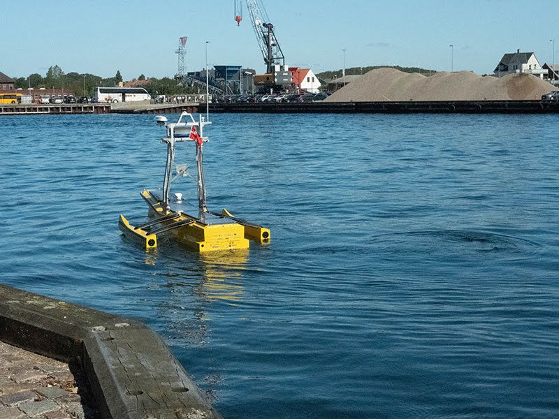
The marine and coastal sectors of Abu Dhabi are constantly evolving with the advancement of maritime infrastructure, ports, and offshore developments. At the heart of this progress lies a highly specialized service: bathymetry surveying. If you’re searching for top bathymetry survey companies in Abu Dhabi, Accurate Survey offers precise, reliable, and technologically advanced hydrographic survey […]
When it comes to any construction or infrastructure project, one of the first and most crucial steps is getting the land surveyed properly. Whether you’re developing a commercial building, planning a residential layout, or working on a government infrastructure project, choosing the right land survey company can make all the difference. But with so many […]
When it comes to any construction or infrastructure project, one of the first and most crucial steps is getting the land surveyed properly. Whether you’re developing a commercial building, planning a residential layout, or working on a government infrastructure project, choosing the right land survey company can make all the difference. But with so many […]
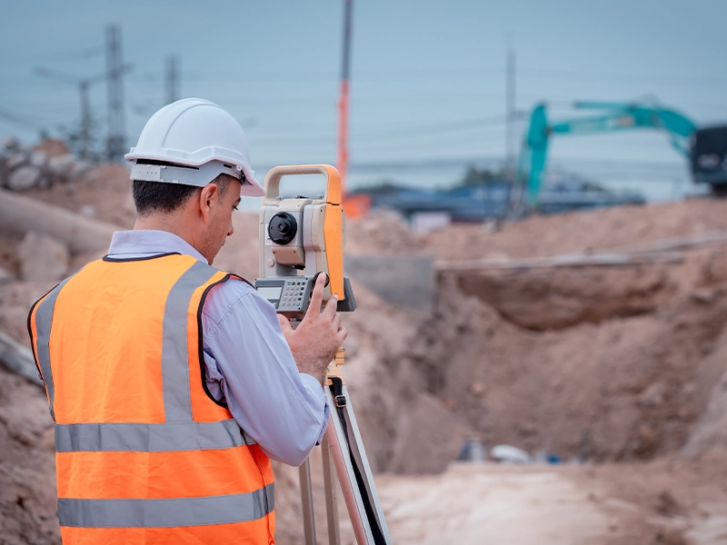
In the fast-evolving landscape of urban development and infrastructure planning, precision and accuracy are non-negotiable. Whether it’s a residential construction, road expansion, or large-scale commercial project, accurate land data is the foundation upon which successful execution is built. This is where professional topographic survey services come into play. Precise mapping is essential for the success […]
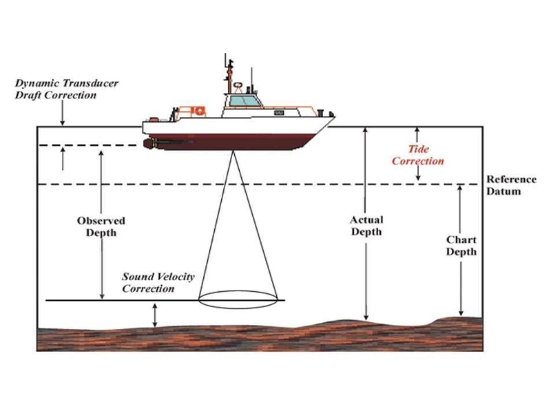
Hydrographic or bathymetric surveying involves mapping and measuring the physical features found beneath water surfaces. It focuses on gathering data about underwater conditions that influence marine activities such as dredging, offshore construction, and drilling. Typically conducted under regulatory authorities, Hydrographic surveying is primarily performed using sensors, sounding techniques, or electronic systems, especially in shallow waters. […]
Choosing the right land survey company is essential when working on property boundaries, construction plans, or infrastructure developments. Dubai’s rapid urban development demands precision and professional expertise. This is where choosing a qualified land surveyor plays a vital role. However, in the rush to get projects started, businesses and individuals often make mistakes in selecting […]
A topographical survey might sound technical, but its purpose is simple: to map the natural and man-made features of a piece of land. Whether you’re planning construction, landscaping, or development, this type of survey gives you the detailed information you need to move forward confidently. At Accurate survey, we’ve been helping clients understand their land. […]