With an aim in our minds to ensure accurate and reliable engineering survey services, Accurate Survey Group was established. The dedication and commitment of the team have aided to consolidate our position at the forefront of the survey with three companies across UAE. Through our exceptional leadership and implication of latest technologies, we deliver superior services whilst emphasizing the quality of the deliverables and safety of our people, operation and the environment. Our goal is to expand our services further and to provide our clients with innovated and integrated solutions.
Anil Kumar
Director of Accurate Survey Engineering
Anil Kumar P.R is the Director of Accurate Survey Engineering with over 20 years of experience in the surveying and engineering industry. He specializes in delivering accurate and reliable survey solutions, including topographic surveys, GIS mapping, and advanced surveying technologies, supporting a wide range of construction and infrastructure projects.
The construction industry in the UAE is known for pushing boundaries. From record-breaking skyscrapers and luxury developments to smart cities and large-scale infrastructure projects, the region demands precision, speed, and innovation at every stage of building. In this fast-evolving landscape, BIM Modeling Services in UAE have become more than just a technological upgrade – they […]
When starting a building project in Dubai, especially a villa construction, many consultants or contractors suddenly hear a comment from Dubai Municipality: “Provide DMD level / Gate Level computation.” For many owners and even junior engineers, this becomes confusing. What exactly is DMD Level? Why does Dubai Municipality require it before approving drawings? And why […]
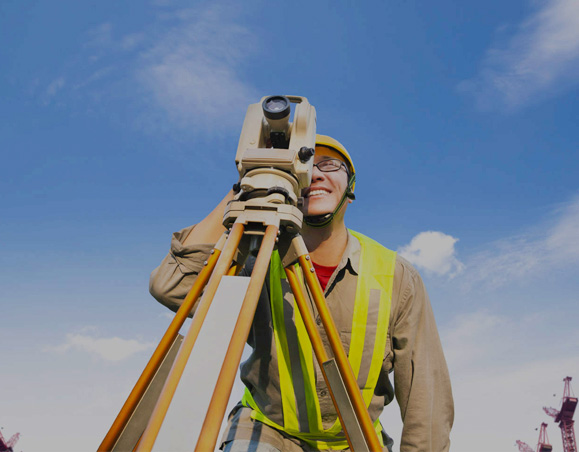
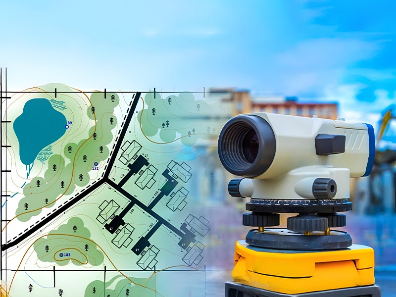
Every construction project begins with a vision: a residential villa, a warehouse, a commercial tower, or even a road network. But before concrete is poured and steel is installed, there is one critical step that quietly determines whether the project will succeed or struggle: Understanding the land! A topographic survey is the process of mapping […]
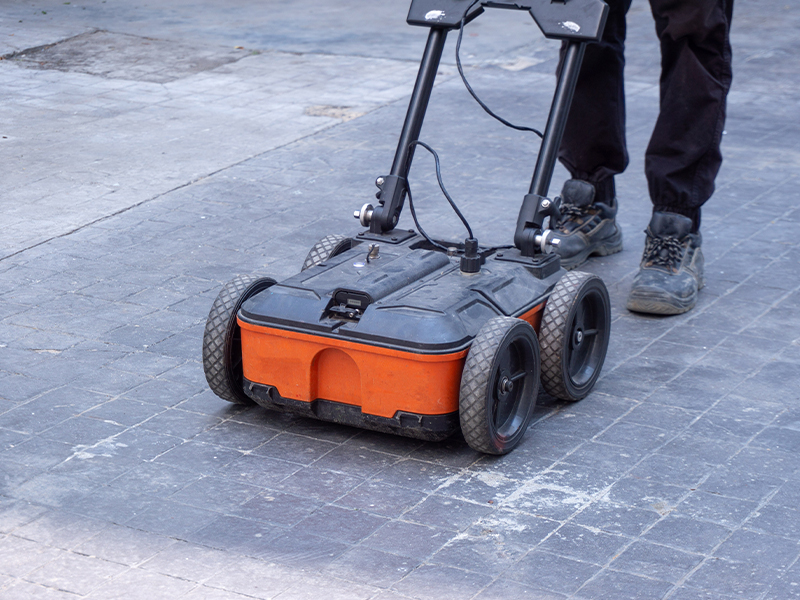
In the UAE’s fast-growing construction landscape, where new towers, commercial spaces, villas, and infrastructure projects rise every day, accuracy and safety are non-negotiable. One small mistake beneath a concrete surface can lead to costly damages, project delays, and serious safety risks. This is why concrete scanning has become an essential step in every drilling, coring, […]
Urban development in the UAE has advanced rapidly over the last few decades from expansive highways and smart cities to world-class residential, commercial, and industrial developments. As cities continue to grow, the need for precise spatial intelligence, infrastructure planning, and sustainable land management has become more important than ever. Geographic Information Systems (GIS) play a […]
In today’s fast-paced construction and infrastructure landscape, accurate survey data is the foundation of every successful project. From early planning to final execution, even a small mistake in mapping or measurement can trigger a chain reaction of costly consequences. Unfortunately, many projects only realize the impact of these errors when it’s too late.At Accurate Survey, we […]
Concrete scanning and imaging have become essential procedural requirements in today’s construction and demolition workflows, especially in rapidly developing urban regions like Dubai, Abu Dhabi and the wider UAE. With dense infrastructure, high-rise developments, and ongoing renovation works, contractors cannot rely solely on drawings or assumptions when cutting, drilling, or modifying concrete structures. Advanced imaging […]
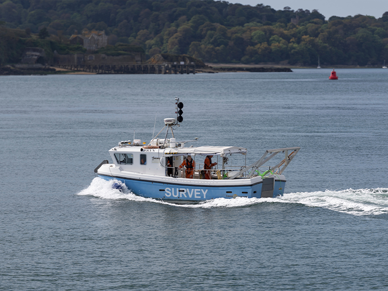
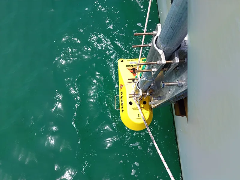
In an era where marine ecosystems face mounting pressures from sea-level rise and coastal erosion to habitat degradation and human-driven disturbances, precise underwater mapping is no longer a niche service. For organisations involved in marine conservation, coastal development or infrastructure near water, understanding the seafloor’s shape, depth and sediment dynamics is essential. That’s where bathymetric […]
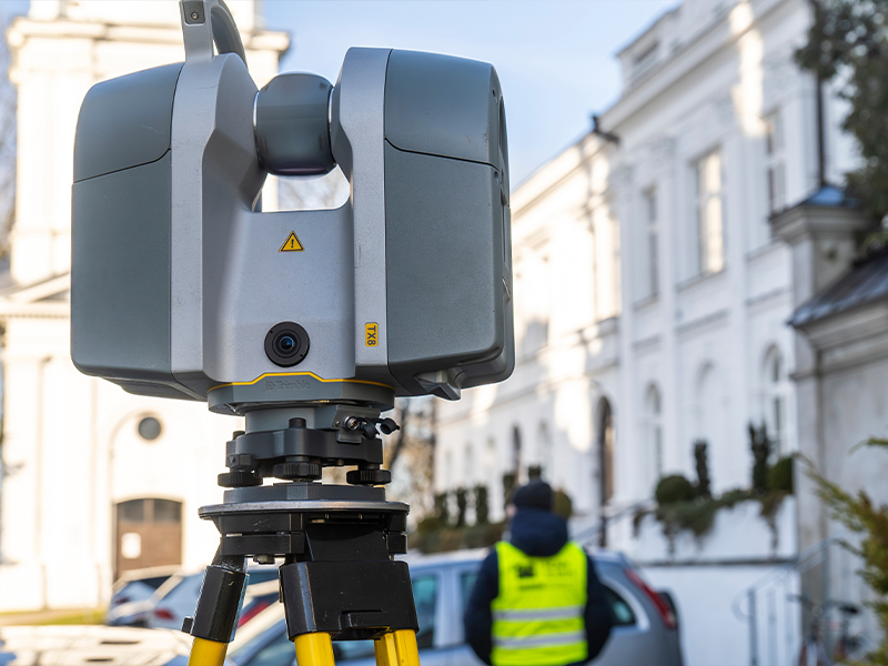
As construction, infrastructure and industrial projects in the UAE and Middle East become ever more complex, the demand for precision, speed and digital intelligence in surveying is growing. Enter 3D laser scanning – a transformative technology enabling high-definition capture of physical reality, instant integration into digital workflows, and data-driven decision making across the project lifecycle. […]
The world beneath the water’s surface is as important as the land we build on. From ports and harbors to offshore infrastructure, understanding the underwater landscape is vital for safe navigation and sustainable development. This is where bathymetric surveys come in. As a leading surveying company in the UAE, Accurate Survey specializes in delivering reliable […]