- Topography Survey
- Stake Out Survey
- Underground Utility Detection Survey(GPR and Cable Detector)
- 3D Laser Scanning
- Mobile Mapping
- Uav Drone/Aerial Survey
- Monitoring Survey
- Control Point Survey
- Architectural/Structural /Mep Asbuilt Survey
- Hydrographic Survey
- Offshore/Onshore Survey Services
- Rebar Scanning and Concrete Imaging
- Dilapidation Survey
- Quantity And Volumetric Survey
- Traffic Survey
Accurate Survey Engineering provides professional topographic survey services in Dubai and across the UAE for construction, infrastructure, industrial, commercial, and land development projects. Our experienced survey engineers use advanced surveying technologies including GPS/GNSS systems, drone surveying, 3D laser scanning, GIS mapping, and total station equipment to deliver highly accurate terrain and geospatial data for projects of all sizes.
As one of the trusted topographic survey companies in UAE, we help developers, contractors, architects, consultants, and infrastructure planners make informed decisions through precise land mapping and terrain analysis solutions.
What Is a Topographic Survey?
A topographic survey is a detailed land mapping process used to measure and represent the natural and artificial features of a site. The survey collects accurate elevation data, contour information, terrain conditions, structures, roads, utilities, and other site elements required for planning and engineering purposes.
Topographic surveys are widely used before construction begins to help engineers, architects, and developers understand the site conditions and prepare accurate project designs.
A professional topographic survey may include:
Accurate topographic mapping is essential for ensuring efficient project planning and minimizing construction errors.
Why Topographic Surveys Are Important in UAE
The UAE continues to experience rapid urban development, infrastructure expansion, and large-scale construction growth. Accurate topographic surveys are essential for supporting these developments across Dubai, Abu Dhabi, Sharjah, and other emirates.
Topographic survey services help:
- Improve construction planning
- Support infrastructure design
- Reduce project risks
- Ensure proper drainage planning
- Improve land utilization
- Enhance project accuracy
- Support smart city developments
- Minimize engineering conflicts
From high-rise developments in Dubai to industrial projects across the UAE, accurate terrain data plays a major role in modern engineering and construction workflows.
Types of Topographic Survey Services
Land Topographic Surveys
Land topographic surveys are used to map open land areas and identify terrain elevations, natural features, contour lines, and land boundaries. These surveys support land development, environmental planning, agricultural projects, and construction site preparation.
Professional land topographic surveys help developers and engineers understand the terrain conditions before starting excavation, grading, or infrastructure work.
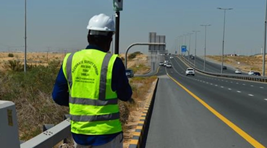
Road and Infrastructure Topographic Surveys
Road and infrastructure topographic surveys are essential for transportation and infrastructure development projects across the UAE. These surveys provide detailed terrain and elevation data required for planning roads, highways, bridges, drainage systems, tunnels, and utility corridors.
Our road and infrastructure topographic surveys include:
- Road corridor mapping
- Elevation analysis
- Drainage assessments
- Utility alignment surveys
- Highway terrain mapping
- Infrastructure planning support
Accurate infrastructure survey data helps improve project efficiency and supports safer construction execution.
Construction Topographic Surveys
Construction topographic surveys help engineers and contractors prepare accurate site layouts before construction begins. These surveys support earthwork calculations, grading analysis, foundation planning, and structural positioning.
Construction surveys are widely used for:
- Residential developments
- Commercial buildings
- Industrial projects
- Infrastructure construction
- Site grading and leveling
Accurate construction survey data helps reduce costly rework and improves overall project coordination.
Utility and Industrial Topographic Surveys
Utility and industrial topographic surveys support complex infrastructure and industrial development projects. These surveys assist in identifying existing utility systems, terrain features, access pathways, and infrastructure limitations.
Utility and industrial surveys may support:
- Pipeline projects
- Oil and gas facilities
- Utility corridor planning
- Industrial plant development
- Electrical and telecom infrastructure
- Water and drainage systems
Features Included in a Topographic Survey
Professional topographic survey companies in UAE provide detailed mapping data that may include:
- Ground elevations
- Contour lines
- Terrain conditions
- Roads and pavements
- Existing buildings
- Drainage systems
- Utility networks
- Trees and vegetation
- Boundary references
- Infrastructure features
- Site access points
- Retaining walls and structures
This data helps improve engineering accuracy and supports efficient project planning.
Technologies Used in Topographic Surveys
Modern topographic surveying relies on advanced technologies to improve precision, efficiency, and data quality.
GPS/GNSS Surveying
GPS and GNSS systems provide highly accurate positioning and coordinate data for land mapping and engineering surveys.
Drone Surveying
Drone surveying helps capture high-resolution aerial imagery and terrain data quickly across large project areas. Drone surveys improve efficiency and support accurate topographic mapping.
Total Station Surveying
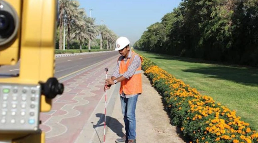
Total station equipment is widely used for measuring distances, angles, elevations, and site coordinates with high precision.
3D Laser Scanning
3D laser scanning captures highly detailed measurements of terrain, structures, and infrastructure for engineering analysis and BIM workflows.
GIS Mapping
GIS technology helps process and visualize geospatial data for planning, infrastructure management, and land analysis applications.
Digital Terrain Modelling (DTM) and Digital Surface Modelling (DSM)
Digital Terrain Modelling (DTM) and Digital Surface Modelling (DSM) are essential components of modern topographic survey services in UAE construction and infrastructure projects.
Digital Terrain Modelling (DTM)
DTM represents the bare-earth terrain surface by capturing accurate elevation and contour data without buildings or vegetation. DTM is widely used for:
- Earthwork planning
- Drainage analysis
- Flood risk assessment
- Infrastructure development
- Site grading
Digital Surface Modelling (DSM)
DSM includes both terrain elevations and above-ground features such as buildings, roads, trees, and infrastructure elements. DSM supports:
- Urban planning
- Smart city projects
- Infrastructure visualization
- Utility planning
- Construction analysis
Professional survey engineers use advanced technologies including drone surveys, LiDAR, GIS mapping, and 3D laser scanning to generate highly accurate DTM and DSM models.
Topographic Survey Process
- Site Inspection: Survey engineers first inspect the site to evaluate terrain conditions, project requirements, and access areas.
- Data Collection: Field teams collect accurate measurements using advanced surveying equipment including GPS systems, drones, and total stations.
- Terrain and Elevation Mapping: Surveyors capture contour lines, ground elevations, structures, and infrastructure details for accurate terrain analysis.
- Data Processing and CAD Drafting: Collected survey data is processed using specialized engineering software to prepare topographic drawings, contour maps, and digital models.
- Quality Verification: Survey engineers verify all collected data to ensure accuracy, consistency, and compliance with project requirements.
Industries We Serve
Our topographic survey services support multiple industries across Dubai and the UAE, including:
- Construction
- Infrastructure
- Real Estate
- Industrial Development
- Oil and Gas
- Transportation
- Utilities
- Marine and Coastal Projects
- Smart City Developments
- Environmental Engineering
Benefits of Professional Topographic Survey Services
Professional topographic surveys provide several advantages for engineering and construction projects.
- Improved Project Planning: Accurate terrain data helps engineers and architects prepare better project designs and layouts.
- Reduced Construction Errors: Detailed topographic information minimizes alignment issues, design conflicts, and costly rework.
- Better Land Utilization: Topographic surveys help optimize land development and infrastructure positioning.
- Enhanced Safety and Compliance: Accurate site analysis improves construction safety and supports regulatory compliance.
- Cost and Time Savings: Early identification of terrain challenges helps reduce project delays and unexpected construction costs.
Topographic Survey vs Boundary Survey
| Topographic Survey | Boundary Survey |
|---|---|
| Maps terrain and site features | Identifies legal property boundaries |
| Includes elevations and contours | Focuses on plot dimensions |
| Used for construction and engineering | Used for legal and ownership purposes |
| Supports infrastructure planning | Supports land ownership verification |
Why Choose Accurate Survey Engineering?
Accurate Survey Engineering is one of the trusted topographic survey companies in UAE, providing reliable and accurate survey engineering solutions for construction, infrastructure, industrial, and land development projects.
Why clients choose us:
- Experienced survey engineers
- Advanced survey technologies
- Accurate terrain mapping solutions
- Fast project delivery
- Reliable geospatial data
- Modern surveying equipment
- UAE project expertise
- Industry-standard workflows
We are committed to delivering accurate and efficient topographic surveying solutions tailored to the needs of every project.
Frequently Asked Questions
Looking for Professional Topographic Survey Services in UAE?

Accurate Survey Engineering provides advanced topographic survey services across Dubai, Abu Dhabi, Sharjah, and throughout the UAE. Our experienced survey engineers deliver accurate terrain mapping, contour surveys, infrastructure surveys, DTM/DSM modelling, and geospatial solutions for construction and engineering projects.
Contact our team today for reliable and accurate topographic surveying solutions in UAE.
Need help with this service? Contact our team today.
Contact Us