

Why Does Scan to BIM Require Multiple Software Platforms?
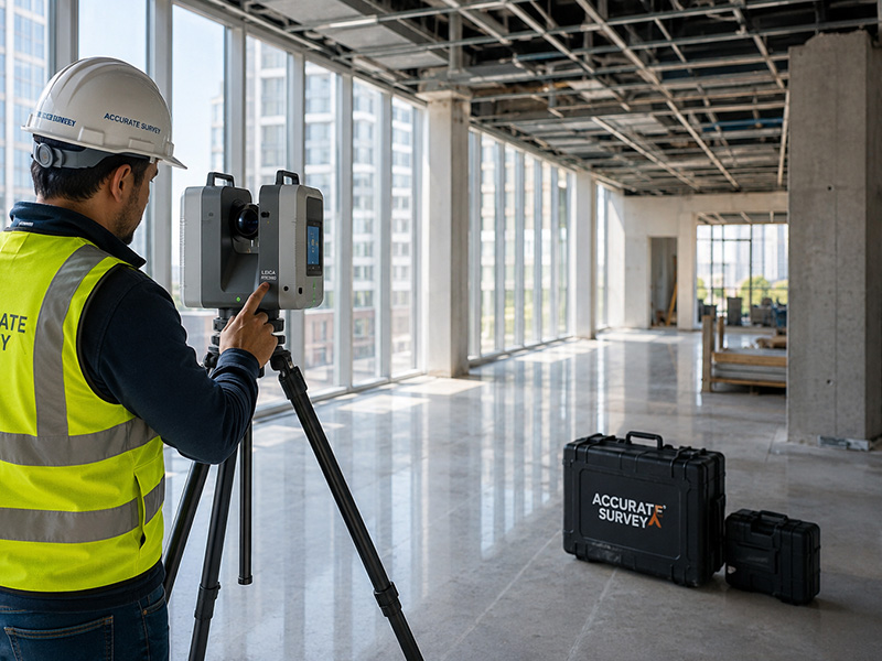
Unlike conventional CAD drafting, Scan to BIM is a multi-stage process that involves collecting, processing, validating, and modeling large volumes of spatial data. Each stage requires different capabilities, which is why professionals use several software platforms instead of relying on a single solution. For example, laser scanners capture millions of measurement points known as point clouds. Before this data can be converted into an intelligent BIM model, it must be registered, cleaned, aligned, and verified for accuracy. Only then can BIM specialists begin creating architectural, structural, or MEP models based on the project requirements. This workflow allows project teams to maintain accuracy throughout every stage while reducing the likelihood of missing information, design conflicts, and costly rework during construction or renovation. For organizations planning renovation projects, facility upgrades, industrial plant modifications, or heritage documentation, using the right combination of software helps ensure that the final BIM model reflects actual site conditions rather than assumptions.Understanding the Complete Scan-to-BIM Software Workflow
Although every project has unique requirements, most professional Scan to BIM services follow a structured workflow. Each stage relies on software designed for a specific task, ensuring that the final BIM model is accurate, coordinated, and ready for design, construction, or facility management.| Project Stage | Purpose | Common Software Used |
|---|---|---|
| Reality Capture | Capture existing site conditions using 3D laser scanners | Leica Cyclone FIELD 360, FARO Stream |
| Point Cloud Registration | Align and merge multiple scans into a unified dataset | Leica Cyclone REGISTER 360, FARO Scene |
| Point Cloud Processing | Clean, optimize, and prepare scan data | Autodesk ReCap Pro, CloudCompare |
| BIM Modeling | Develop intelligent BIM models from point cloud data | Autodesk Revit |
| Quality Verification | Check model accuracy and identify inconsistencies | Navisworks Manage, Solibri |
| Collaboration & Review | Coordinate project information across teams | Autodesk Construction Cloud |
How Software Fits into the Scan to BIM Process
Understanding where each software application is used becomes easier when you look at the complete project workflow.Existing Building
↓
↓
Point Cloud Registration
↓
↓
BIM Modeling
↓
Quality Verification
↓
Project Coordination
↓
Final BIM Deliverables
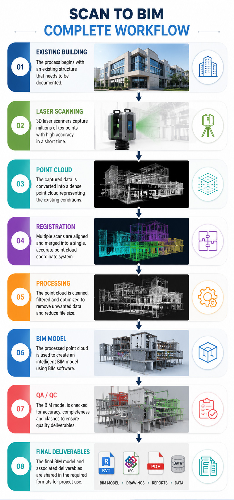 Each stage contributes to creating an accurate digital representation of the existing building.
- Laser scanning software captures precise measurements from the physical environment.
- Registration software combines individual scans into a single coordinated point cloud.
- Processing software removes unwanted data and prepares the point cloud for modeling.
- BIM software transforms the processed data into intelligent architectural, structural, or MEP models.
- Quality control software verifies model accuracy and checks for coordination issues before project delivery.
- Collaboration platforms help project teams review, manage, and share BIM information efficiently.
Software Supports the Workflow: Expertise Delivers the Results
One common misconception is that purchasing advanced software automatically guarantees an accurate Scan to BIM model. In reality, software is only one part of the process. Reliable results depend on experienced surveyors who capture accurate site data, BIM specialists who understand modeling standards, and quality assurance teams who verify that every element meets the required project specifications. Decisions made during data collection, point cloud interpretation, and model development have a significant impact on the quality of the final deliverable. For this reason, professional Scan to BIM services are built around a combination of advanced technology, standardized workflows, and technical expertise rather than software alone.Software Used for 3D Laser Scanning
Every successful Scan to BIM project begins with accurate site data. Before a BIM model can be developed, professionals need to capture the existing building or structure in its current condition. This is where 3D laser scanning software plays a critical role. Modern terrestrial laser scanners collect millions of measurement points within minutes, producing a highly detailed point cloud that represents the physical environment. The software integrated with these scanners helps control the scanning process, manage field data, and ensure that complete site information is captured before leaving the project location. Some of the commonly used software platforms include:- Leica Cyclone FIELD 360
- FARO Stream
- Trimble Perspective
Software Used for Point Cloud Registration
Once site data has been collected, the individual scans must be combined into a single, coordinated point cloud. Since large projects are scanned from multiple positions, each scan needs to be accurately aligned with the others before modeling begins. This stage is commonly referred to as point cloud registration. Registration software identifies common reference points between scans and merges them into one complete dataset while maintaining spatial accuracy. Professionals commonly use software such as:- Leica Cyclone REGISTER 360
- FARO Scene
- Trimble RealWorks
- Align multiple scan positions
- Improve overall dataset accuracy
- Detect registration errors
- Organize large scanning projects
- Prepare data for BIM modeling
Software Used for Point Cloud Processing
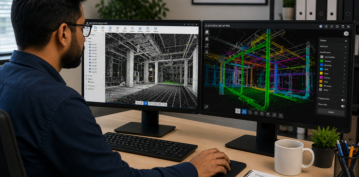 After registration, the point cloud typically contains far more information than is required for BIM modeling. Temporary objects, unnecessary scan data, background elements, and duplicate information need to be removed before modeling can begin.
This stage is known as point cloud processing.
Processing software helps optimize the dataset while preserving the accuracy needed for architectural, structural, and MEP modeling.
Professionals commonly rely on the following applications:
After registration, the point cloud typically contains far more information than is required for BIM modeling. Temporary objects, unnecessary scan data, background elements, and duplicate information need to be removed before modeling can begin.
This stage is known as point cloud processing.
Processing software helps optimize the dataset while preserving the accuracy needed for architectural, structural, and MEP modeling.
Professionals commonly rely on the following applications:
- Autodesk ReCap Pro
- CloudCompare
- EdgeWise
- Remove unwanted scan data
- Clean and organize point clouds
- Optimize file sizes
- Improve project performance
- Prepare datasets for BIM platforms
- Export industry-standard file formats
Why Point Cloud Quality Matters More Than Software Alone
Many people assume that using advanced software automatically results in an accurate BIM model. In reality, software can only work effectively when the underlying point cloud has been captured and processed correctly. Poor scan planning, incomplete site coverage, or inaccurate registration can introduce errors that continue throughout the modeling process. Even the most advanced BIM software cannot compensate for missing or inaccurate survey data. For this reason, professional Scan to BIM projects place equal importance on:- Proper survey planning
- High-quality laser scanning
- Accurate point cloud registration
- Thorough data processing
- Experienced technical review
Choosing Software Based on Project Requirements
There is no single software platform that suits every Scan to BIM project. Selecting the right software often depends on factors such as:- Building size and complexity
- Required Level of Detail (LOD)
- Project objectives
- Client deliverables
- File format requirements
- Scanner compatibility
- Coordination with architects, engineers, and contractors
BIM Modeling Software Used by Professionals
After the point cloud has been registered and processed, the next step is converting that information into an intelligent Building Information Model. This stage requires BIM software capable of accurately representing architectural, structural, and MEP components while maintaining the level of detail required for the project. Among the available platforms, Autodesk Revit is one of the most widely adopted solutions for professional Scan to BIM projects. Rather than simply recreating building geometry, it enables BIM specialists to develop data-rich models that support design coordination, construction planning, quantity take-offs, facility management, and future renovations. Using the processed point cloud as a reference, modelers create BIM elements such as:- Walls and partitions
- Floors and ceilings
- Columns and beams
- Doors and windows
- Roof systems
- Mechanical, electrical, and plumbing (MEP) components
- Structural elements
Quality Control Software Helps Verify Model Accuracy
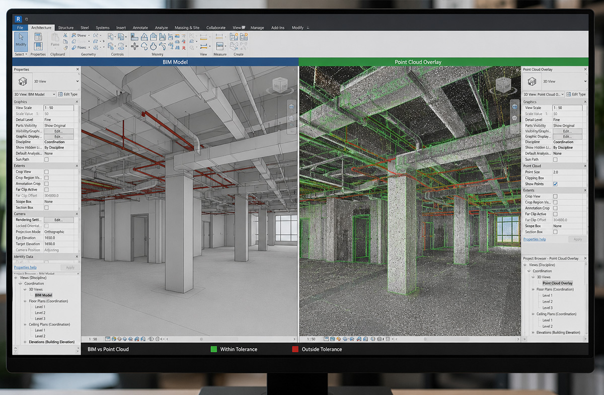 Creating a BIM model is only part of the process. Before it is delivered to the client, the model must be reviewed to ensure it accurately reflects the captured site conditions.
Quality control software allows professionals to compare the completed BIM model with the original point cloud, helping identify inconsistencies before they affect design or construction activities.
Commonly used platforms include:
Creating a BIM model is only part of the process. Before it is delivered to the client, the model must be reviewed to ensure it accurately reflects the captured site conditions.
Quality control software allows professionals to compare the completed BIM model with the original point cloud, helping identify inconsistencies before they affect design or construction activities.
Commonly used platforms include:
- Autodesk Navisworks Manage
- Solibri Office
- Comparing BIM models against point cloud data
- Reviewing model completeness
- Detecting coordination issues between disciplines
- Identifying potential clashes
- Supporting design reviews before construction begins
Collaboration Platforms Improve Project Coordination
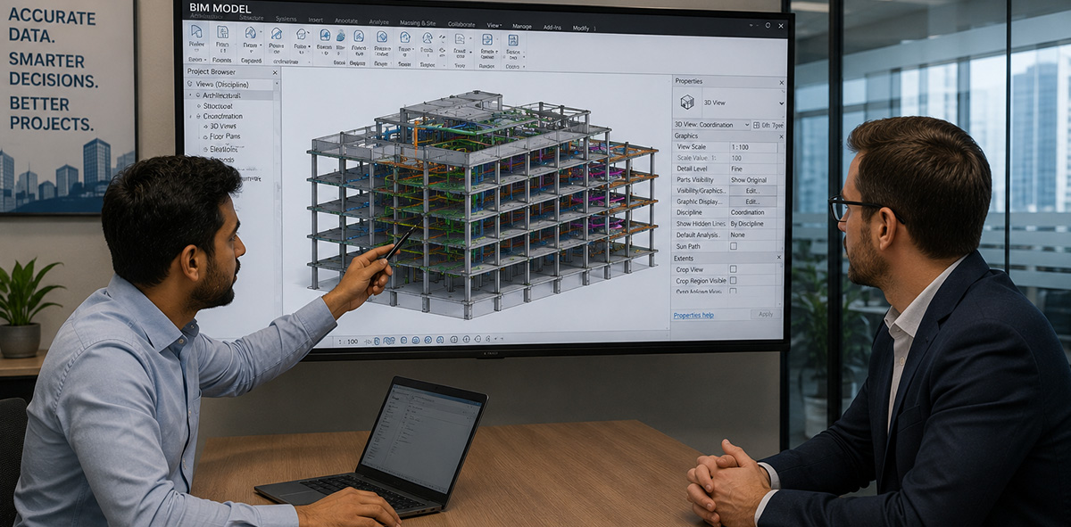 Modern Scan to BIM projects often involve multiple stakeholders, including surveyors, architects, structural engineers, MEP consultants, contractors, and facility managers. Keeping project information organized becomes essential as models progress through different stages of development.
Cloud-based collaboration platforms provide a central environment where project teams can review models, share updates, manage revisions, and coordinate information throughout the project.
Some commonly used platforms include:
Modern Scan to BIM projects often involve multiple stakeholders, including surveyors, architects, structural engineers, MEP consultants, contractors, and facility managers. Keeping project information organized becomes essential as models progress through different stages of development.
Cloud-based collaboration platforms provide a central environment where project teams can review models, share updates, manage revisions, and coordinate information throughout the project.
Some commonly used platforms include:
- Autodesk Construction Cloud
- Autodesk BIM Collaborate Pro
- Access the latest project information
- Manage model revisions
- Review design changes
- Coordinate multidisciplinary workflows
- Improve communication between project participants
How Professionals Select the Right Software
There is no universal software combination for every Scan to BIM project. Experienced professionals choose software based on the technical requirements, project objectives, and client deliverables rather than following a fixed workflow. Selecting the most suitable software depends on factors such as:Building Type
Commercial buildings, industrial facilities, healthcare projects, residential developments, and heritage structures each present different surveying and modeling challenges.Required Level of Detail (LOD)
Higher LOD requirements generally demand more advanced modeling workflows and greater attention to detail throughout the project.Point Cloud Size
Large industrial facilities or infrastructure projects generate substantial volumes of scan data that require software capable of efficiently processing and managing complex datasets.Client Deliverables
Some projects require native Revit files, while others may require IFC models, CAD drawings, clash reports, or asset information for facility management systems.Project Timeline
Fast-track renovation and construction projects often require workflows that improve productivity without compromising model accuracy. Selecting software based on these project-specific requirements helps maintain efficiency while ensuring that the final BIM model meets both technical and operational expectations.Does Using Better Software Guarantee Better Scan to BIM Results?
One of the biggest misconceptions about Scan to BIM is that the latest software automatically produces better models. In reality, software is only one part of a much larger process. An accurate BIM model begins with careful survey planning, followed by precise laser scanning, reliable point cloud registration, thorough data processing, and disciplined quality control. Every stage relies on the expertise of the professionals involved, from survey engineers capturing accurate site data to BIM specialists developing detailed digital building models. Even the most advanced software cannot compensate for incomplete scans, poor registration, or incorrect modeling decisions. Likewise, experienced professionals can often achieve exceptional results because they understand how to apply the right tools at the right stage of the workflow. For this reason, successful Scan to BIM projects are driven by a combination of technical expertise, established workflows, and industry-standard software rather than software alone.Delivering Reliable Scan to BIM Solutions for Complex Projects
Professional Scan to BIM projects require more than technical software knowledge. They demand an understanding of surveying principles, building systems, BIM standards, and project coordination to ensure the final model meets the intended purpose. At Accurate Survey, every Scan to BIM project follows a structured workflow that combines high-precision laser scanning, professional point cloud processing, intelligent BIM modeling, and rigorous quality verification. This integrated approach enables the delivery of accurate digital models that support renovation planning, construction coordination, infrastructure development, and long-term facility management. By selecting the most appropriate software for each stage of the workflow and combining it with experienced technical expertise, project teams can develop BIM models that provide lasting value throughout the building lifecycle.Conclusion
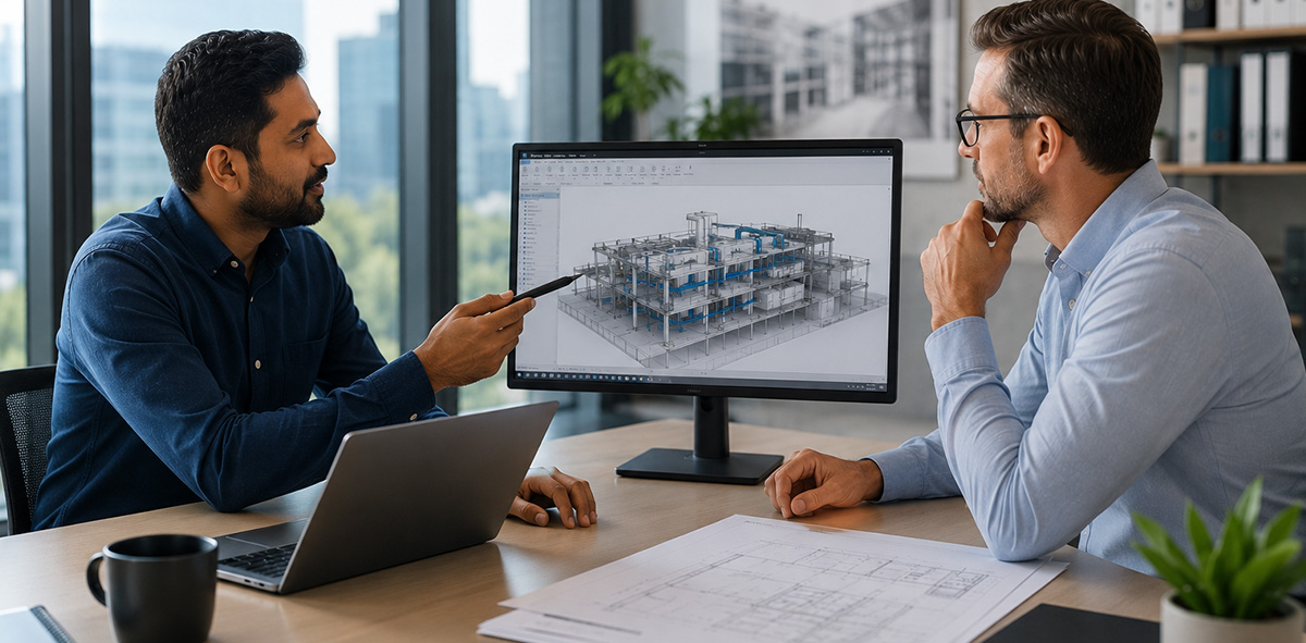 Choosing the right software is an important part of any Scan to BIM project, but successful outcomes depend on much more than the tools themselves. Professional workflows combine accurate reality capture, reliable point cloud processing, intelligent BIM modeling, and rigorous quality verification to create digital models that can be confidently used throughout a building’s lifecycle.
Since every project has different objectives, there is no single software solution that fits every requirement. Commercial developments, industrial facilities, hospitals, infrastructure projects, and heritage buildings each require a tailored approach based on project complexity, Level of Detail (LOD), and expected deliverables.
At Accurate Survey, our Scan to BIM workflow combines industry-standard software with experienced surveying and BIM professionals to deliver accurate, information-rich models for renovation, construction, facility management, and asset documentation. By selecting the right tools for each stage of the workflow and maintaining strict quality standards, we help clients make informed decisions with reliable digital building information.
Whether you’re planning a refurbishment, documenting an existing facility, or developing an as-built BIM model, understanding the role of each software platform can help you appreciate the expertise involved in delivering a successful Scan to BIM project.
Choosing the right software is an important part of any Scan to BIM project, but successful outcomes depend on much more than the tools themselves. Professional workflows combine accurate reality capture, reliable point cloud processing, intelligent BIM modeling, and rigorous quality verification to create digital models that can be confidently used throughout a building’s lifecycle.
Since every project has different objectives, there is no single software solution that fits every requirement. Commercial developments, industrial facilities, hospitals, infrastructure projects, and heritage buildings each require a tailored approach based on project complexity, Level of Detail (LOD), and expected deliverables.
At Accurate Survey, our Scan to BIM workflow combines industry-standard software with experienced surveying and BIM professionals to deliver accurate, information-rich models for renovation, construction, facility management, and asset documentation. By selecting the right tools for each stage of the workflow and maintaining strict quality standards, we help clients make informed decisions with reliable digital building information.
Whether you’re planning a refurbishment, documenting an existing facility, or developing an as-built BIM model, understanding the role of each software platform can help you appreciate the expertise involved in delivering a successful Scan to BIM project.