

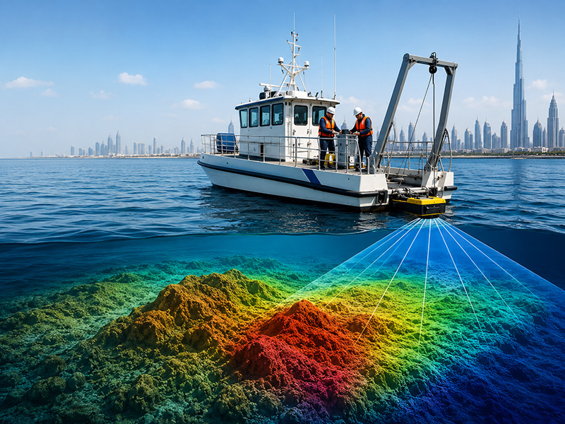
Hiring a bathymetry service is not simply about finding a company that can measure water depths. The survey data may be used to plan dredging work, design marine structures, assess navigation channels, calculate seabed volumes, plan offshore installations, or monitor changes in underwater terrain. For these applications, the quality and suitability of the survey data can have a direct impact on later project decisions.
This is why choosing a bathymetry survey provider requires more than comparing quotations. Different companies may use different equipment, survey methods, processing techniques, quality-control procedures, and reporting standards.
Before appointing a provider, it is worth asking a few important questions to understand exactly what you are getting and whether the proposed survey will meet your project requirements.
Table of Contents
ToggleWhat Should I Ask Before Choosing a Bathymetry Service?
1. Do You Have Experience With Projects Similar to Mine?
One of the first questions to ask is whether the company has worked on projects comparable to yours.
Bathymetric surveying requirements can vary considerably. A small marina survey, for example, may have very different requirements from a large dredging project, offshore pipeline route, navigation channel, or port development.
Ask the survey company about:
- Similar projects they have completed
- Their experience in comparable water depths
- Experience with similar seabed conditions
- Experience working in ports, rivers, reservoirs, coastal areas, or offshore environments
- Previous projects with similar accuracy and deliverable requirements
Relevant experience can help the survey team anticipate site-specific challenges and select a more appropriate survey methodology.
2. Which Bathymetry Survey Method Do You Recommend?
There is no single bathymetric survey method that is suitable for every project.
Depending on the survey area and objectives, a provider may recommend technologies such as:
- Single-beam echo sounding
- Multibeam echo sounding
- USV-based bathymetric surveying
- Side-scan sonar
- GNSS positioning
- Sound velocity profiling
- Tide or water-level observations
- Other supporting hydrographic equipment
Instead of simply asking which equipment the company owns, ask:
“Which survey method would you recommend for my project, and why?”
The provider should be able to explain how the proposed method relates to your water depth, required coverage, accuracy, seabed characteristics, accessibility, and intended use of the data.
3. What Level of Accuracy Can You Achieve?
Accuracy is one of the most important aspects of a bathymetry survey.
Rather than accepting a general statement such as “our survey is highly accurate,” ask the provider to explain the expected horizontal and vertical accuracy and how these values will be achieved.
You can ask:
- What horizontal positioning accuracy can you achieve?
- What depth accuracy can be expected?
- How is vessel movement accounted for?
- How is the survey position established?
- How are water-level variations handled?
- What quality-control checks are performed?
The required accuracy should be based on the actual purpose of the survey. A project requiring detailed engineering information may have considerably different accuracy requirements from a preliminary investigation.
4. What Equipment Will Be Used?
Ask the provider to identify the main equipment that will be used during the survey.
Depending on the project, this could include:
- Single-beam echo sounders
- Multibeam echo sounders
- GNSS receivers
- Motion sensors
- Side-scan sonar
- Sound velocity profilers
- Tide gauges
- Unmanned Surface Vessels
- Hydrographic data-processing systems
The equipment itself is only part of the equation. What matters is whether the equipment configuration is appropriate for the site and project requirements.
A good provider should be able to explain why the selected equipment is suitable rather than simply listing technical specifications.
5. What Area Will the Survey Cover?
Before the work starts, make sure the survey limits are clearly defined.
Ask:
- What area will be surveyed?
- Are the boundaries based on coordinates or drawings?
- Will the entire area be covered?
- Are there areas that cannot be surveyed?
- What survey-line spacing will be used?
- Will additional lines be required for quality control?
This is particularly important when comparing different quotations. Two companies may quote for the same project but make different assumptions about the actual survey coverage.
6. Will You Use Single-Beam or Multibeam Technology?
If you are unsure which technology is appropriate, ask the provider to explain the difference.
A single-beam echo sounder generally records depth measurements along the vessel’s survey track. Multibeam systems collect multiple measurements across a wider swath, allowing more comprehensive seabed mapping.
Neither system is automatically the right choice for every project.
The decision should consider:
- Required seabed coverage
- Survey area
- Water depth
- Required accuracy
- Seabed characteristics
- Project objectives
- Required deliverables
- Time available for fieldwork
The survey company should be able to justify its recommendation based on these factors.
7. What Survey Standards or Specifications Will You Follow?
Ask which standards, specifications, or project requirements will be used when planning and executing the survey.
Depending on the project, there may be specific requirements relating to:
- Positioning accuracy
- Depth accuracy
- Survey coverage
- Data quality
- Vertical referencing
- Quality control
- Reporting
If your project has specifications provided by an engineer, consultant, contractor, port authority, or other organisation, give them to the survey provider before the quotation is prepared.
This allows the survey methodology and deliverables to be developed around the actual project requirements.
8. How Will Tides and Water-Level Changes Be Handled?
Water levels can change during a survey, particularly in coastal and tidal environments.
Ask the provider how water-level variations will be measured and accounted for and which vertical reference system will be used.
Questions to clarify include:
- Will tide observations be required?
- How will changing water levels be recorded?
- Which vertical datum will be used?
- How will the measured depths be referenced to the required level?
These details can become particularly important when the survey is being used for dredging, construction levels, navigation, or engineering design.
9. Will Sound Velocity Be Measured?
Sound travels through water at varying speeds, influenced by factors such as temperature, salinity, and pressure.
For acoustic bathymetric surveys, variations in sound velocity can influence the accuracy of depth measurements and seabed positioning.
Ask whether sound velocity profiling will be carried out and how the resulting information will be incorporated into data processing.
This is an important technical consideration, especially for detailed multibeam surveys.
10. What Deliverables Will I Receive?
Do not assume that every bathymetry company provides the same final outputs.
Ask the provider to list the deliverables clearly in the quotation.
Depending on the project requirements, the final deliverables may include:
- Bathymetric charts
- Depth soundings
- Contour maps
- Digital Terrain Models
- XYZ data
- Point clouds
- 3D seabed models
- Cross-sections
- Longitudinal profiles
- Dredging volume calculations
- Survey drawings
- Processed datasets
- Survey reports
- Quality-control documentation
Knowing the exact deliverables before the survey begins helps prevent misunderstandings later.
11. Can You Provide the Data in Our Required Format?
The survey data may need to be transferred into engineering, CAD, GIS, modelling, or project-management systems.
Ask whether the provider can supply the data in the formats your team requires.
For example:
- CAD-compatible drawings
- GIS-compatible datasets
- XYZ point files
- Surface models
- Digital Terrain Models
- Point-cloud data
- PDF reports
- Other project-specific formats
If you already have a preferred file format or coordinate system, communicate this before the survey begins.
12. How Long Will the Entire Survey Take?
Ask for a realistic timeline covering more than just the time spent collecting data in the field.
A bathymetry project may involve:
- Survey planning
- Mobilisation
- Equipment preparation
- Field data collection
- Data processing
- Quality control
- Drawing preparation
- Report preparation
- Final delivery
The fieldwork may be completed quickly, but processing and reporting can require additional time.
The duration of a survey may vary based on factors such as the survey area, water depth, required coverage, weather and sea conditions, accessibility, vessel availability, and overall project complexity.
13. What Could Cause Delays?
It is useful to understand potential delays before the survey starts.
Ask whether the schedule could be affected by:
- Poor weather
- Rough sea conditions
- Tidal conditions
- Restricted access
- Marine traffic
- Equipment availability
- Vessel availability
- Site restrictions
- Permission requirements
- Unexpected seabed conditions
Knowing these factors in advance makes it easier to establish a realistic project programme.
14. Is Mobilisation Included in the Quotation?
Mobilisation costs are sometimes treated separately from the actual survey work.
Ask whether the quotation includes:
- Survey vessel mobilisation
- Equipment transportation
- Survey crew mobilisation
- Equipment installation
- Calibration
- Site preparation
- Demobilisation
If these items are excluded, ask for the expected additional costs before approving the project.
15. How Do You Check the Quality of the Survey Data?
Data collection is only one part of a bathymetric survey. Quality control is equally important.
Ask the provider how it checks the collected data.
This may involve:
- Equipment calibration
- Position checks
- Survey-line checks
- Vessel-motion corrections
- Sound velocity corrections
- Tide corrections
- Data validation
- Identification of anomalous measurements
- Cross-checks between survey lines
- Review of processed datasets
Ask the provider to explain how questionable or incomplete data is identified before the final deliverables are issued.
16. What Happens If There Are Data Gaps?
Unexpected problems can sometimes occur during marine surveys.
For example, certain areas may be inaccessible, environmental conditions may affect data collection, or some measurements may not meet the required quality level.
Ask:
“If there are data gaps or areas that do not meet the agreed requirements, what happens next?”
Clarify:
- When a re-survey is required
- Who determines whether the data is acceptable
- Whether additional fieldwork is included
- How re-survey costs are handled
- How incomplete areas will be reported
Having this clearly established in advance can avoid disagreements after the survey.
17. What Safety Procedures Do You Follow?
Bathymetric surveying involves working on or near water, often around vessels, marine infrastructure, moving equipment, and active work sites.
Ask the provider about its safety procedures, including:
- Risk assessments
- Personnel safety
- Vessel safety
- Emergency procedures
- Marine traffic management
- Personal protective equipment
- Site-specific safety requirements
A professional survey operation should have appropriate safety procedures in place before personnel and equipment are deployed.
18. Who Is Responsible for Permissions and Site Access?
Some survey locations may require prior approval or coordination with:
- Port authorities
- Harbour operators
- Government authorities
- Site owners
- Marine operators
- Infrastructure owners
- Other project stakeholders
Ask the survey company whether it will assist with the necessary permissions and who is responsible for obtaining them.
Also confirm whether application fees or other related costs are included in the quotation.
19. What Exactly Is Included in the Price?
Price should always be considered in relation to the scope of work.
Ask for a clear breakdown of what the quotation includes.
This could cover:
- Survey equipment
- Vessel
- Survey personnel
- Mobilisation
- Fieldwork
- Data processing
- Quality control
- Drawings
- Reports
- Data formats
- Permits
- Travel
- Additional survey work
A lower quotation is not necessarily the most economical option if important elements are excluded.
20. Are There Any Additional Costs I Should Know About?
Before accepting a quotation, ask whether any circumstances could result in additional charges.
For example:
- Additional survey days
- Additional survey areas
- Re-survey requirements
- Extended vessel hire
- Additional data processing
- Extra deliverables
- Permit fees
- Mobilisation changes
- Unforeseen site conditions
Having these conditions documented beforehand makes the commercial side of the project much clearer.
21. Can You Recommend a Cost-Effective Survey Approach?
A professional survey company should not automatically recommend the most expensive technology.
Instead, ask:
“Which approach can deliver the required results without conducting unnecessary survey work?”
The objective should be to balance:
Accuracy + Coverage + Data Requirements + Time + Cost
For example, a project may not require full high-resolution multibeam coverage if its purpose only involves obtaining targeted depth information. Conversely, using a lower-density survey where detailed seabed modelling is required could result in insufficient data.
The right approach is the one that meets the project’s actual requirements.
When Is Multibeam Bathymetry Worth Considering?
If your project requires detailed and comprehensive seabed mapping, ask whether a multibeam survey would be appropriate.
Multibeam systems collect numerous depth measurements across a wider area beneath and around the survey vessel. This makes the technology particularly useful for applications where detailed seabed coverage is important.
These may include:
- Port and harbour surveys
- Dredging projects
- Navigation channels
- Offshore construction
- Marine infrastructure
- Seabed change monitoring
- Detailed engineering investigations
However, multibeam should not automatically be selected simply because it is a more advanced technology. The survey provider should consider the project’s objectives, water depth, required accuracy, coverage, seabed characteristics, timeframe, and final data requirements.
Why Does the Right Bathymetry Service Provider Matter?
Bathymetric surveying involves much more than collecting water-depth readings.
The final result depends on several stages, including survey planning, positioning, data acquisition, environmental corrections, processing, quality control, interpretation, and reporting.
If any of these stages are poorly planned or executed, the resulting data may not provide the level of information required for engineering or operational decisions.
Selecting a suitable survey provider at the beginning can therefore help reduce the risk of incomplete data, unexpected costs, delays, and unsuitable deliverables.
Conclusion
Choosing the right bathymetry service provider involves more than comparing the price quoted for fieldwork. Before hiring a company, consider its experience, survey methodology, equipment, accuracy, coverage, applicable standards, environmental corrections, deliverables, data processing, quality control, project timeline, safety procedures, permissions, and overall pricing.
Most importantly, the provider should be able to explain why its proposed survey approach is suitable for your specific project requirements. A clearly defined scope of work and detailed quotation can make it easier to compare providers and ensure that the resulting bathymetric data meets its intended purpose.
Accurate Survey provides bathymetry and hydrographic surveying solutions for a range of marine and coastal applications. By combining appropriate survey methods, accurate data collection, quality-control processes, and project-specific deliverables, Accurate Survey can support informed decision-making for marine construction, dredging, port development, offshore infrastructure, coastal projects, and environmental applications.
When selecting a bathymetry service, choosing an experienced and technically capable provider such as Accurate Survey can help establish a reliable foundation for the engineering, planning, and operational decisions that follow.