

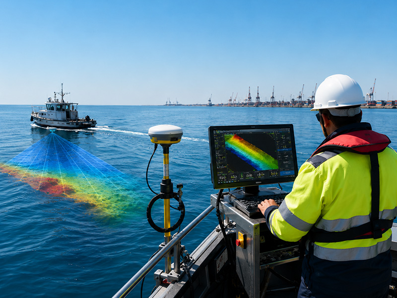
In many projects, additional technologies such as side-scan sonar, GNSS, tide measurement and sound velocity profiling are integrated with bathymetric systems to provide a more complete understanding of the underwater environment.
In this guide, we explain the different types of bathymetry surveys, how they work, where they are used and how to determine which method is suitable for a project.
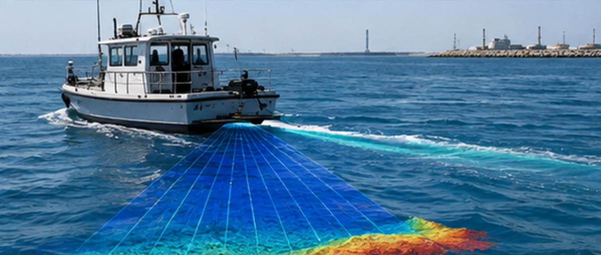 Different water environments and project requirements demand different surveying approaches.
For example, a small shallow-water area may be efficiently surveyed using a single-beam echo sounder, while a large port or offshore development may require multibeam technology to obtain comprehensive high-resolution coverage.
Similarly, very shallow or difficult-to-access areas may benefit from unmanned surface vessels, while airborne LiDAR can be useful for mapping shallow coastal environments over relatively large areas.
The choice of bathymetry method generally depends on:
Different water environments and project requirements demand different surveying approaches.
For example, a small shallow-water area may be efficiently surveyed using a single-beam echo sounder, while a large port or offshore development may require multibeam technology to obtain comprehensive high-resolution coverage.
Similarly, very shallow or difficult-to-access areas may benefit from unmanned surface vessels, while airborne LiDAR can be useful for mapping shallow coastal environments over relatively large areas.
The choice of bathymetry method generally depends on:
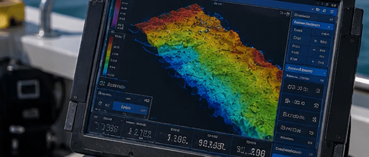 A Multibeam Echo Sounder (MBES) collects multiple depth measurements across a wide swath of the seabed during each survey pass.
Instead of measuring only a narrow line beneath the vessel, a multibeam system produces broad coverage across the survey area. The collected data can be used to generate detailed bathymetric surfaces and three-dimensional representations of the seabed.
Multibeam bathymetry is particularly valuable when high-resolution and comprehensive seabed mapping are required.
A Multibeam Echo Sounder (MBES) collects multiple depth measurements across a wide swath of the seabed during each survey pass.
Instead of measuring only a narrow line beneath the vessel, a multibeam system produces broad coverage across the survey area. The collected data can be used to generate detailed bathymetric surfaces and three-dimensional representations of the seabed.
Multibeam bathymetry is particularly valuable when high-resolution and comprehensive seabed mapping are required.
The choice should not simply be based on which system is more advanced. The correct approach depends on the project’s required accuracy, coverage, water depth, seabed characteristics, budget and final deliverables.
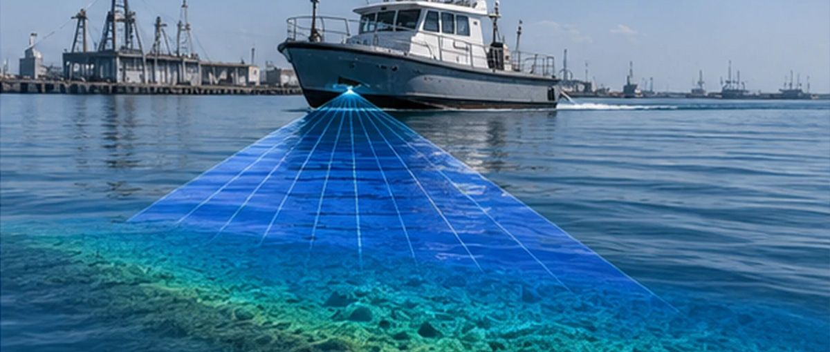 Different types of bathymetry surveys serve different project requirements. Single-beam systems can provide efficient depth measurements for targeted applications, while multibeam systems offer dense and comprehensive seabed coverage. Bathymetric LiDAR and satellite-derived methods can provide valuable solutions for suitable shallow-water and large-area applications, while USV-based systems offer flexibility in shallow or restricted environments.
In many marine projects, the most effective results are achieved by integrating bathymetry with positioning, motion compensation, tide observations, sound velocity data, and seabed imaging technologies.
Selecting the appropriate survey method is therefore not just a matter of choosing the most advanced equipment. It is about matching the technology and methodology to the project’s environment, accuracy requirements, coverage, objectives and final deliverables.
Accurate Survey Engineering provides professional hydrographic and bathymetric surveying solutions across the UAE, supporting marine construction, dredging, coastal development, environmental monitoring and other underwater mapping requirements.
Different types of bathymetry surveys serve different project requirements. Single-beam systems can provide efficient depth measurements for targeted applications, while multibeam systems offer dense and comprehensive seabed coverage. Bathymetric LiDAR and satellite-derived methods can provide valuable solutions for suitable shallow-water and large-area applications, while USV-based systems offer flexibility in shallow or restricted environments.
In many marine projects, the most effective results are achieved by integrating bathymetry with positioning, motion compensation, tide observations, sound velocity data, and seabed imaging technologies.
Selecting the appropriate survey method is therefore not just a matter of choosing the most advanced equipment. It is about matching the technology and methodology to the project’s environment, accuracy requirements, coverage, objectives and final deliverables.
Accurate Survey Engineering provides professional hydrographic and bathymetric surveying solutions across the UAE, supporting marine construction, dredging, coastal development, environmental monitoring and other underwater mapping requirements.
What Is a Bathymetry Survey?
A bathymetry survey is the process of measuring water depths and mapping the underwater topography of oceans, seas, rivers, lakes, reservoirs, channels and other water bodies. Similar to how a topographic survey maps the elevation and shape of land, a bathymetric survey produces information about the depth, contours, slopes and features of the seabed or underwater surface. Modern bathymetric surveys commonly use acoustic, optical or remote-sensing technologies to collect depth information. The resulting data can be processed into depth charts, contour maps, Digital Terrain Models (DTMs), 3D seabed models and other engineering deliverables. Bathymetry is also an important component of hydrographic surveying. While hydrographic surveying covers a wider range of measurements associated with water bodies, bathymetry specifically focuses on water depth and underwater topography.Why Are There Different Types of Bathymetry Surveys?
Different water environments and project requirements demand different surveying approaches.
For example, a small shallow-water area may be efficiently surveyed using a single-beam echo sounder, while a large port or offshore development may require multibeam technology to obtain comprehensive high-resolution coverage.
Similarly, very shallow or difficult-to-access areas may benefit from unmanned surface vessels, while airborne LiDAR can be useful for mapping shallow coastal environments over relatively large areas.
The choice of bathymetry method generally depends on:
- Survey area and water depth
- Required positional and depth accuracy
- Required seabed coverage
- Seabed conditions
- Water clarity
- Tidal and environmental conditions
- Accessibility of the survey area
- Project schedule
- Required data resolution
- Regulatory or engineering requirements
1. Single-Beam Bathymetry Survey
A Single-Beam Echo Sounder (SBES) measures water depth directly beneath the survey platform. The system transmits an acoustic pulse toward the seabed. The sound wave reflects from the bottom and returns to the transducer. By measuring the travel time of the acoustic signal and applying the appropriate corrections, the system determines the water depth. Single-beam systems are relatively straightforward and can be highly effective when survey requirements do not demand full seabed coverage.Where Is Single-Beam Bathymetry Used?
Single-beam bathymetry can be used for:- River and canal surveys
- Reservoir surveys
- Small harbours and waterways
- Dredging surveys
- Pre- and post-dredging assessments
- Coastal surveys
- Channel depth measurements
- Monitoring changes in seabed elevation
- Volumetric calculations
2. Multibeam Bathymetry Survey
A Multibeam Echo Sounder (MBES) collects multiple depth measurements across a wide swath of the seabed during each survey pass.
Instead of measuring only a narrow line beneath the vessel, a multibeam system produces broad coverage across the survey area. The collected data can be used to generate detailed bathymetric surfaces and three-dimensional representations of the seabed.
Multibeam bathymetry is particularly valuable when high-resolution and comprehensive seabed mapping are required.
Where Is Multibeam Bathymetry Used?
Multibeam surveys are commonly used for:- Port and harbour development
- Navigation channel surveys
- Dredging and dredging-volume calculations
- Offshore infrastructure projects
- Coastal engineering
- Pipeline and cable route investigations
- Pre-construction surveys
- Post-construction surveys
- Seabed change monitoring
- Detailed marine mapping
3. Bathymetric LiDAR Survey
Bathymetric LiDAR uses laser pulses from an airborne platform to measure water depth and map shallow underwater environments. Unlike conventional acoustic bathymetry, which uses sound waves, LiDAR uses light. The system can measure the water surface and seabed returns, allowing depth information to be derived in suitable conditions. Bathymetric LiDAR can be particularly useful for surveying shallow coastal areas, where operating a conventional survey vessel may be difficult or inefficient.Applications of Bathymetric LiDAR
Potential applications include:- Shallow coastal mapping
- Nearshore surveys
- Beach and shoreline studies
- Coastal zone management
- Habitat mapping
- Large-area coastal mapping
- Environmental monitoring
4. Satellite-Derived Bathymetry
Satellite-Derived Bathymetry (SDB) uses satellite imagery and optical remote sensing techniques to estimate water depth in suitable shallow-water environments. Instead of collecting measurements directly from a survey vessel, satellite imagery is processed to derive information about underwater depth. This approach can be useful for obtaining broad-scale information over large areas and for preliminary assessments or areas where conventional access is challenging.Where Can Satellite-Derived Bathymetry Be Used?
Potential applications include:- Coastal zone assessment
- Preliminary marine planning
- Shallow-water mapping
- Large-area environmental studies
- Coastal change assessment
- Remote-area reconnaissance
5. USV-Based Bathymetric Survey
Unmanned Surface Vessels (USVs) provide another way of collecting bathymetric data, particularly in shallow, restricted or difficult-to-access environments. A USV can be equipped with an echo sounder, GNSS positioning system and other sensors to collect underwater depth measurements without requiring personnel to remain onboard the survey platform. USV-based surveys can improve operational flexibility and may reduce the risks associated with working in certain environments.Applications of USV Bathymetry
USV-based bathymetric surveys can be used in:- Shallow coastal areas
- Harbours and ports
- Reservoirs
- Lakes
- Rivers and canals
- Dams
- Ponds
- Channels
- Restricted-access water bodies
- Environmentally sensitive areas
6. Bathymetry Surveys for Dredging
Dredging projects often require bathymetric surveys at different stages of the project. A pre-dredging survey establishes the existing seabed surface and helps determine the volume and areas requiring excavation. During dredging, additional surveys may be used to monitor progress. A post-dredging bathymetric survey verifies the resulting seabed levels and can be used to calculate the remaining or completed dredged volume. High-resolution bathymetric data can therefore support better dredging planning, quantity calculations and verification.7. Bathymetry Surveys for Ports and Harbours
Ports and harbours require accurate information about water depths, channels, berths and seabed conditions. Bathymetric surveys can support:- Navigation channel assessment
- Berth maintenance
- Dredging planning
- Port expansion
- Seabed change monitoring
- Construction planning
- Post-construction verification
8. River, Canal and Reservoir Bathymetry
Bathymetry is not limited to marine environments. Rivers, canals and reservoirs can also experience sedimentation, erosion and changes in underwater profiles. Bathymetric surveys can measure these changes and support maintenance, water-resource management and engineering planning. In reservoirs, for example, bathymetric data can be combined with elevation information to calculate underwater storage capacity and identify changes caused by sediment accumulation.9. Environmental and Coastal Bathymetry
Bathymetric data also supports environmental monitoring and coastal management. Changes in seabed elevation can provide information about erosion, sediment transport and changes in underwater habitats. When combined with other environmental datasets, bathymetry can contribute to marine habitat mapping, coastal resilience planning and environmental assessments. Bathymetric surveys can therefore support projects involving:- Coastal erosion monitoring
- Sediment movement studies
- Marine habitat assessment
- Environmental impact assessments
- Marine spatial planning
- Coastal restoration
- Long-term seabed monitoring
Single-Beam vs Multibeam Bathymetry
One of the most common decisions in bathymetric surveying is whether to use single-beam or multibeam technology.| Feature | Single-Beam Bathymetry | Multibeam Bathymetry |
|---|---|---|
| Measurement | Individual depth points along survey lines | Multiple depth points across a swath |
| Seabed coverage | Narrower | Broad |
| Data density | Lower | Higher |
| Detailed seabed modelling | Suitable for selected applications | Highly suitable |
| Large-area mapping | Can require more survey lines | Efficient for comprehensive coverage |
| Typical applications | Rivers, channels, dredging and targeted surveys | Ports, harbours, offshore and detailed seabed mapping |
| Project complexity | Suitable for many straightforward surveys | Suitable for detailed and complex marine projects |
What Other Technologies Are Used With Bathymetry?
A bathymetric survey does not always rely on a single sensor. Depending on the project, several technologies can be integrated to improve the quality and usefulness of the final dataset.- GNSS and Positioning Systems: GNSS provides accurate positioning information so that each depth measurement can be correctly located.
- Motion Sensors and IMU: Motion sensors help compensate for vessel movement such as roll, pitch, heave and heading during data acquisition.
- Tide Measurement: In tidal environments, water-level information is important for reducing measured depths to the appropriate vertical reference.
- Sound Velocity Profiling: Sound velocity in water varies according to factors such as temperature, salinity and pressure. Sound velocity information is therefore important for processing acoustic bathymetric data accurately.
- Side-Scan Sonar: Side-scan sonar is not primarily a depth-measuring system. Instead, it produces detailed acoustic imagery of the seabed and can help identify objects, obstructions, debris and other seabed features.
How Do You Choose the Right Type of Bathymetry Survey?
Selecting the appropriate bathymetric method requires consideration of the project’s technical and environmental requirements. A professional survey team may evaluate:- Water depth – Shallow, intermediate and deep-water environments may require different equipment.
- Survey coverage – Large areas requiring comprehensive coverage may benefit from multibeam systems.
- Required accuracy – Engineering and regulatory requirements can influence the survey methodology.
- Seabed characteristics – Sediment, rock, vegetation and other seabed conditions can affect data acquisition.
- Accessibility – Restricted or shallow areas may be suitable for USV-based surveying.
- Water clarity – Optical methods such as bathymetric LiDAR depend on suitable water conditions.
- Project purpose – Navigation, dredging, construction, environmental monitoring and volumetric surveys can have different data requirements.
- Final deliverables – The required charts, DTMs, contours, 3D models, volume calculations or reports influence the appropriate survey approach.
Bathymetry vs Hydrographic Survey: Are They the Same?
Bathymetry and hydrographic surveying are closely related, but they are not exactly the same. Bathymetry focuses primarily on measuring water depth and mapping underwater topography. Hydrographic surveying has a broader scope and can include bathymetry along with measurements and investigations related to tides, water levels, seabed features, navigation, currents and other marine conditions. Therefore, bathymetry can be considered an important component of hydrographic surveying. This distinction is particularly useful when defining the scope of a marine engineering or coastal development project because the required survey may extend beyond depth measurement alone.Why Professional Bathymetric Surveying Matters
The quality of bathymetric data can directly influence engineering decisions, dredging quantities, navigation safety and construction planning. Professional bathymetric surveying combines suitable sensors, accurate positioning, appropriate survey planning, environmental corrections, data processing and quality control. Accurate Survey provides hydrographic and bathymetric surveying solutions using technologies including single-beam and multibeam echo sounders, USV-based systems and other supporting survey equipment. Its hydrographic capabilities are designed for applications ranging from inland waterways and ports to coastal and offshore environments.Bathymetry Surveys in the UAE
The UAE’s extensive coastline, ports, harbours, artificial islands, marine infrastructure and ongoing coastal development create a strong need for accurate underwater mapping. Bathymetric surveys can support projects involving:- Port and harbour development
- Dredging
- Coastal engineering
- Marine infrastructure
- Offshore construction
- Pipeline and cable routes
- Environmental monitoring
- Navigation and channel assessment
- Seabed change monitoring
Conclusion
Different types of bathymetry surveys serve different project requirements. Single-beam systems can provide efficient depth measurements for targeted applications, while multibeam systems offer dense and comprehensive seabed coverage. Bathymetric LiDAR and satellite-derived methods can provide valuable solutions for suitable shallow-water and large-area applications, while USV-based systems offer flexibility in shallow or restricted environments.
In many marine projects, the most effective results are achieved by integrating bathymetry with positioning, motion compensation, tide observations, sound velocity data, and seabed imaging technologies.
Selecting the appropriate survey method is therefore not just a matter of choosing the most advanced equipment. It is about matching the technology and methodology to the project’s environment, accuracy requirements, coverage, objectives and final deliverables.
Accurate Survey Engineering provides professional hydrographic and bathymetric surveying solutions across the UAE, supporting marine construction, dredging, coastal development, environmental monitoring and other underwater mapping requirements.