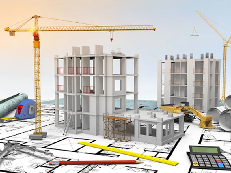
Understanding BIM Modeling in Construction
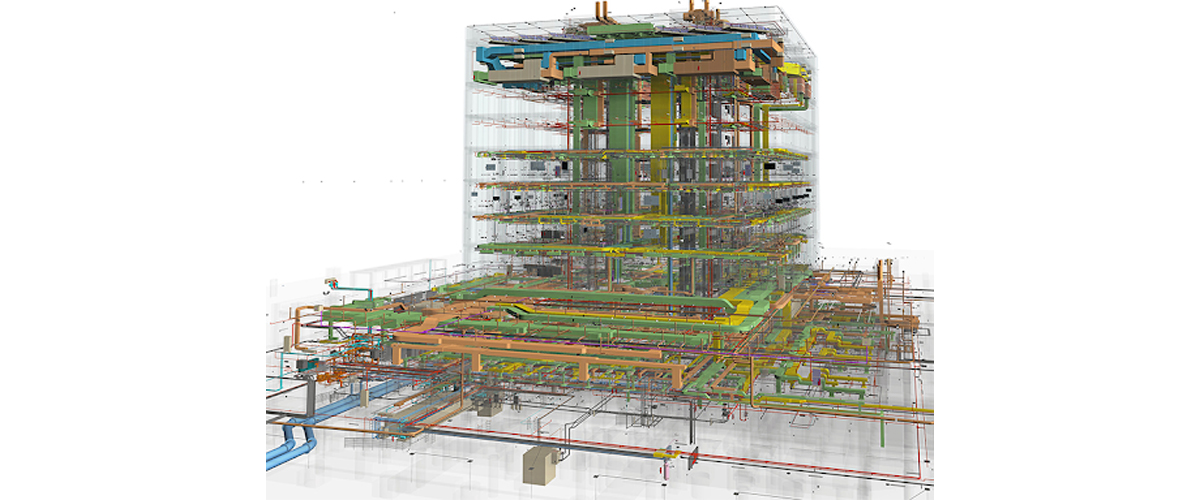
BIM modeling is a digital representation of the physical and functional characteristics of a building or infrastructure project. Unlike traditional 2D drawings, BIM creates a comprehensive 3D model that includes detailed information about structural elements, materials, dimensions, and systems.
Key advantages of BIM modeling include:
- Improved design visualization
- Better collaboration among project teams
- Reduced design conflicts and errors
- Efficient project planning and scheduling
- Enhanced facility management after construction
However, BIM models can only be as accurate as the data used to create them. Without reliable site data, BIM models may not accurately represent real-world conditions, leading to costly mistakes during construction.
Why Land Surveying Is Essential for BIM Accuracy
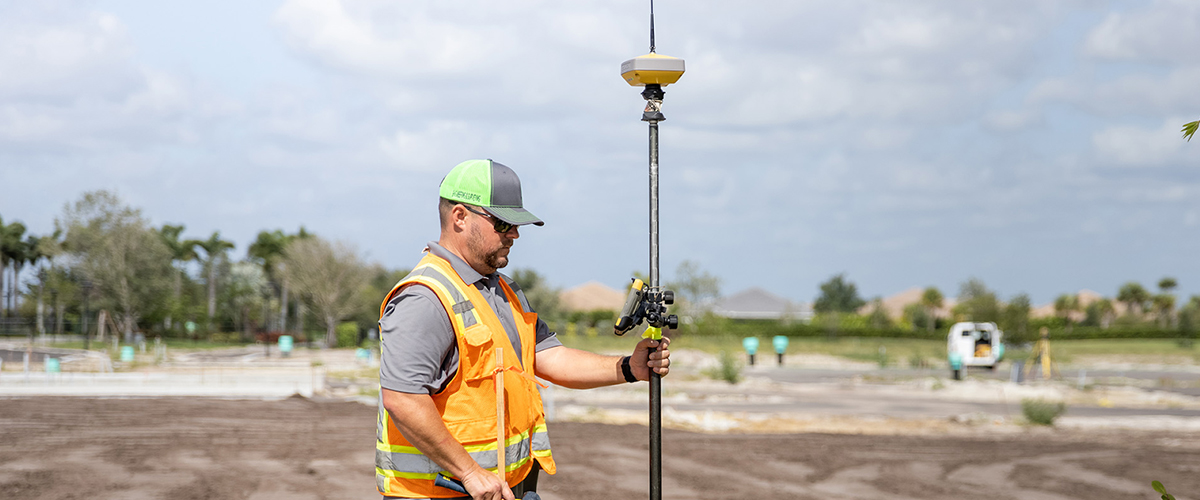
Land surveying plays a critical role in collecting precise spatial data about a construction site. Survey engineers measure terrain elevations, boundaries, existing structures, utilities, and other important site details.
This information is then used to develop accurate BIM models that represent the site conditions before construction begins.
Some of the key benefits of integrating land surveying with BIM include:
1. Accurate Site Representation
Survey data ensures that the BIM model accurately reflects the real-world site conditions. This prevents discrepancies between the design and the actual terrain or infrastructure on site.
2. Reduced Construction Errors
Inaccurate site data can lead to major design conflicts during construction. Land surveying helps eliminate these issues by providing reliable measurements that guide BIM modeling.
3. Better Project Planning
Accurate survey data enables engineers to identify potential challenges early in the design phase. This improves planning, resource allocation, and construction scheduling.
4. Improved Collaboration
Survey data integrated into BIM models allows architects, engineers, and contractors to work with the same accurate information, improving communication and coordination.
Types of Survey Data Used in BIM Modeling
Several types of survey data are commonly used to support BIM modeling in construction projects.
Topographic Surveys
Topographic surveys capture detailed information about terrain elevations, slopes, and natural features of the land. These surveys are essential for site planning and grading design.
As-Built Surveys
As-built surveys document the actual dimensions and locations of structures after construction. These surveys help update BIM models to reflect the completed project accurately.
Construction Surveys
Construction surveys guide the precise placement of building components during construction, ensuring that the structure aligns with the BIM model and project plans.
Utility Surveys
Utility surveys identify underground utilities such as water lines, drainage systems, and electrical cables, helping engineers avoid conflicts during construction.
Technologies That Enhance Survey Data for BIM
Advancements in surveying technology have significantly improved the accuracy and efficiency of data collection used in BIM modeling.
3D Laser Scanning
3D laser scanning captures millions of precise measurement points from the physical environment. This data creates detailed point clouds that can be directly converted into BIM models.
Drone Surveying
Drone-based surveys enable rapid data collection for large construction sites. High-resolution aerial imagery and photogrammetry provide accurate terrain models for BIM integration.
GNSS and GPS Surveying
Modern GNSS and GPS systems allow survey engineers to capture highly accurate geospatial data that can be seamlessly integrated into digital construction workflows.
These technologies help improve the reliability of BIM models while reducing the time required for site data collection.
How Land Surveying Improves BIM Workflows

Integrating surveying data into BIM workflows creates a more efficient construction process.
- Better Design Accuracy: Design teams can rely on precise site data when creating BIM models, reducing the risk of design errors and miscalculations.
- Early Problem Detection: Survey-based BIM models help identify design conflicts before construction begins, allowing teams to resolve issues early.
- Enhanced Project Coordination: When survey data is incorporated into BIM platforms, all stakeholders can access consistent project information, improving coordination across disciplines.
- Improved Construction Efficiency: Accurate BIM models based on survey data reduce the need for costly design revisions and construction adjustments.
BIM and Surveying in UAE Construction Projects
The construction industry in the UAE increasingly relies on BIM technology for large-scale infrastructure and building projects. Government regulations and digital construction initiatives have encouraged companies to adopt BIM-based workflows to improve project efficiency and transparency.
Engineering survey services play a critical role in supporting these BIM-driven construction projects by delivering accurate site measurements and spatial data required for digital modeling.
Companies specializing in both surveying and BIM services help developers and contractors ensure that digital models reflect real-world site conditions, leading to better project outcomes.
The Future of Surveying and BIM Integration
As digital construction technologies continue to evolve, the integration of surveying and BIM will become even more important. Emerging technologies such as digital twins, AI-powered design analysis, and automated construction systems will rely heavily on precise spatial data.
Surveying professionals will play a key role in providing the foundational data required for these advanced construction technologies.
By combining accurate survey measurements with advanced BIM modeling techniques, construction teams can deliver projects faster, safer, and more efficiently.
Partner with Accurate Survey for Reliable BIM and Survey Solutions
Successful BIM modeling depends on precise and reliable site data. By combining advanced surveying technologies with digital construction workflows, project teams can ensure that their BIM models accurately represent real-world site conditions.
At Accurate Survey Engineering, we provide professional engineering survey services that support accurate BIM modeling for construction and infrastructure projects across the UAE. Our experienced survey engineers use advanced technologies such as 3D laser scanning, GNSS surveying, and drone mapping to deliver precise spatial data for digital construction environments.
Whether you are planning a new development, managing a large construction project, or implementing BIM-based workflows, our team can provide the accurate survey data required for efficient project planning and execution.