Working with experienced land survey companies in Dubai helps businesses and property owners avoid costly project delays, legal complications, inaccurate site data, and approval issues. Professional survey engineering services ensure projects comply with Dubai Municipality regulations, land department standards, and UAE construction requirements.
This guide explains the key land survey regulations and approvals in Dubai, why they matter, and how accurate survey engineering supports smooth project execution across the UAE construction industry.
 Land survey regulations in Dubai are designed to maintain accuracy, safety, legal compliance, and proper urban planning throughout the emirate. These regulations help authorities verify property boundaries, infrastructure alignment, construction positioning, and land ownership records.
Surveying regulations also ensure that all construction and development activities follow approved coordinates, elevation data, and mapping standards required by Dubai authorities.
Professional land surveyors must follow approved methodologies, calibrated equipment standards, and precise geospatial measurement practices during every stage of a project.
Land survey regulations in Dubai are designed to maintain accuracy, safety, legal compliance, and proper urban planning throughout the emirate. These regulations help authorities verify property boundaries, infrastructure alignment, construction positioning, and land ownership records.
Surveying regulations also ensure that all construction and development activities follow approved coordinates, elevation data, and mapping standards required by Dubai authorities.
Professional land surveyors must follow approved methodologies, calibrated equipment standards, and precise geospatial measurement practices during every stage of a project.
 Different projects require different types of land surveys depending on the project scope, land condition, and authority requirements.
 Dubai’s construction industry depends heavily on precise geospatial data due to the complexity of modern developments and infrastructure projects.
Accurate survey engineering helps:
Dubai’s construction industry depends heavily on precise geospatial data due to the complexity of modern developments and infrastructure projects.
Accurate survey engineering helps:
 Selecting a professional and experienced land survey company is important for project success.
Businesses should consider:
Selecting a professional and experienced land survey company is important for project success.
Businesses should consider:
Understanding Land Survey Regulations in Dubai
Land survey regulations in Dubai are designed to maintain accuracy, safety, legal compliance, and proper urban planning throughout the emirate. These regulations help authorities verify property boundaries, infrastructure alignment, construction positioning, and land ownership records.
Surveying regulations also ensure that all construction and development activities follow approved coordinates, elevation data, and mapping standards required by Dubai authorities.
Professional land surveyors must follow approved methodologies, calibrated equipment standards, and precise geospatial measurement practices during every stage of a project.
Why Are Land Survey Approvals Important?
Survey approvals are essential for many construction, infrastructure, and real estate activities in Dubai. Without proper approvals and verified survey data, projects may face:- Construction delays
- Permit rejection
- Boundary disputes
- Incorrect site positioning
- Design errors
- Legal complications
- Increased project costs
- Infrastructure conflicts
Key Authorities Involved in Land Survey Approvals in Dubai
Several government entities regulate and approve land surveying activities in Dubai. Each authority may have different requirements depending on the type of project.Dubai Municipality
Dubai Municipality is one of the main authorities responsible for regulating construction standards, engineering compliance, and geospatial data accuracy in Dubai. The municipality oversees:- Site survey requirements
- Construction positioning compliance
- Infrastructure alignment verification
- Topographic data standards
- GIS and mapping integration
- Engineering survey accuracy
- Building construction
- Infrastructure development
- Road projects
- Utility installations
- Land development works
Dubai Land Department (DLD)
Dubai Land Department manages property registration, ownership verification, and land-related legal documentation. Survey-related responsibilities may include:- Boundary verification
- Plot dimension confirmation
- Land ownership mapping
- Property subdivision approvals
- Title deed-related survey records
Trakhees
Trakhees regulates engineering and construction activities within specific free zones and development areas in Dubai. Survey approvals may be needed for:- Industrial projects
- Port developments
- Logistics zones
- Free zone infrastructure
- Commercial developments
DEWA and Utility Authorities
Utility providers such as DEWA may require approved survey data before underground utility installations and infrastructure works begin. Survey approvals may support:- Utility routing
- Cable alignment
- Pipeline positioning
- Elevation verification
- Underground mapping
Types of Land Surveys Commonly Required in Dubai
Different projects require different types of land surveys depending on the project scope, land condition, and authority requirements.
Boundary Surveys
Boundary surveys identify and verify property limits, plot dimensions, and legal boundaries. These surveys help avoid disputes between neighboring properties and ensure accurate land development planning. Boundary surveys are commonly required before:- Property transactions
- Construction projects
- Land subdivision
- Fence installations
- Development approvals
Topographic Surveys
Topographic surveys collect detailed information about the natural and man-made features of a site. This may include:- Elevation levels
- Slopes
- Roads
- Utilities
- Buildings
- Trees
- Drainage systems
Construction Surveys
Construction surveys ensure that structures are positioned correctly according to approved engineering drawings. These surveys support:- Site layout marking
- Foundation positioning
- Structural alignment
- Column setting out
- Elevation verification
As-Built Surveys
As-built surveys document the final constructed conditions of a project after completion. They verify:- Actual dimensions
- Installed utility positions
- Structural alignment
- Elevation accuracy
- Final construction layout
Utility Surveys
Utility surveys identify underground infrastructure such as:- Water pipelines
- Electrical cables
- Telecom lines
- Sewage systems
- Gas pipelines
Survey Approval Process in Dubai
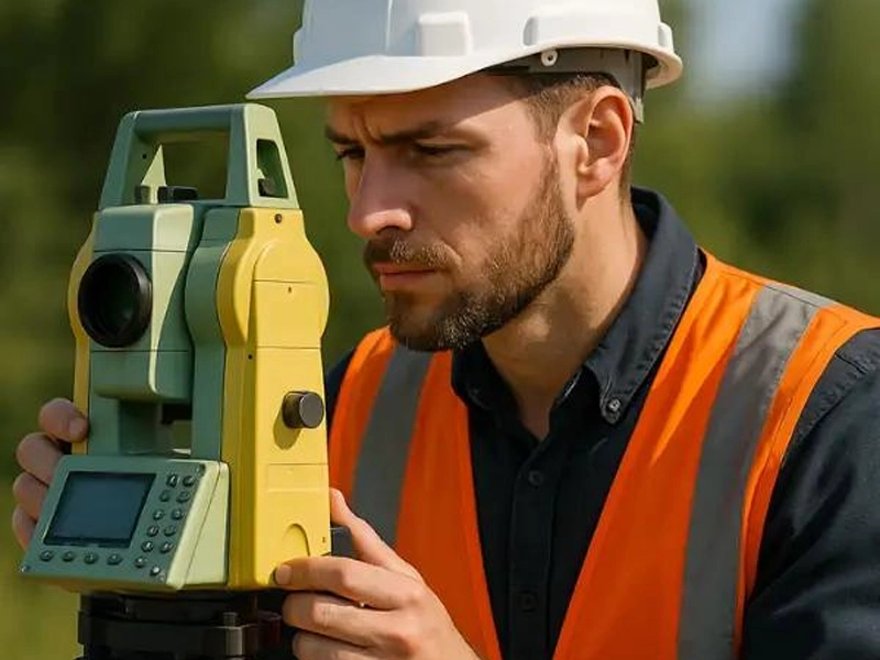
The survey approval process may vary depending on the authority and project type, but generally includes several important stages.1. Site Data Collection
Professional survey engineers visit the site to collect accurate measurements using advanced surveying equipment such as:- GPS/GNSS systems
- Total stations
- 3D laser scanners
- Drone surveying technology
2. Data Processing and Mapping
Collected survey data is processed using specialized engineering software to generate:- Survey drawings
- Contour maps
- Coordinate reports
- CAD files
- GIS datasets
3. Technical Verification
Survey data undergoes quality checks to ensure:- Coordinate accuracy
- Proper alignment
- Elevation consistency
- Boundary correctness
- Compliance with approved standards
4. Submission to Authorities
The final survey documents are submitted to the relevant authority for review and approval. Authorities may review:- Plot coordinates
- Building positioning
- Survey methodology
- Infrastructure alignment
- Mapping standards
5. Approval and Project Execution
Once approved, the survey data can be used for:- Construction permits
- Site execution
- Engineering design
- Infrastructure installation
- Final project approvals
Common Challenges in Land Survey Approvals
Many projects face delays due to inaccurate or incomplete survey information. Common challenges include:- Incorrect coordinates
- Outdated site data
- Boundary discrepancies
- Non-compliant drawings
- Utility conflicts
- Improper elevation measurements
- Missing documentation
- Low survey accuracy
Importance of Accurate Survey in Dubai Construction
Dubai’s construction industry depends heavily on precise geospatial data due to the complexity of modern developments and infrastructure projects.
Accurate survey engineering helps:
- Improve project planning
- Reduce construction errors
- Prevent legal disputes
- Ensure authority compliance
- Enhance project safety
- Support BIM workflows
- Optimize infrastructure positioning
- Minimize costly project delays
- High-rise buildings
- Roads and bridges
- Rail infrastructure
- Industrial facilities
- Smart city developments
- Marine construction projects
Modern Survey Technologies Used in Dubai
Modern land survey companies in Dubai use advanced technologies to improve efficiency and accuracy.GNSS and GPS Surveying
GNSS technology provides highly accurate positioning data for large-scale projects and infrastructure developments.Drone Surveying
Drone surveys help capture aerial data quickly for:- Large land areas
- Construction monitoring
- Topographic mapping
- Volume calculations
3D Laser Scanning
3D laser scanning captures detailed site measurements and creates accurate digital models for engineering and BIM applications.GIS Mapping
GIS technology helps manage geospatial information for urban planning, utilities, and infrastructure management.How Land Survey Regulations Contribute to Dubai’s Urban Development
Dubai continues to develop major infrastructure, transportation, and smart city projects. Accurate surveying regulations help authorities maintain:- Organized urban expansion
- Infrastructure safety
- Property accuracy
- Sustainable development
- Efficient land utilization
- Residential communities
- Commercial towers
- Transportation networks
- Airports and ports
- Industrial zones
- Smart infrastructure systems
Selecting the Right Land Survey Company in Dubai
Selecting a professional and experienced land survey company is important for project success.
Businesses should consider:
- Technical expertise
- Regulatory knowledge
- Modern equipment
- Accuracy standards
- Industry experience
- Project portfolio
- Approval support capabilities
- Compliance with Dubai regulations
Why Accurate Survey Engineering Matters for UAE Projects
Professional land surveying services are essential for maintaining precision and compliance throughout construction and infrastructure projects in Dubai and across the UAE. From initial site planning to final project handover, accurate survey engineering supports:- Better decision-making
- Efficient project execution
- Reduced construction risk
- Improved legal compliance
- Long-term infrastructure reliability