At Accurate Survey, GIS technology is integrated into survey workflows to support urban planning, infrastructure development, utilities, asset management, environmental monitoring, and transport planning across the UAE.
Let’s explore how GIS is transforming urban planning and development throughout the Emirates and why it has become an essential tool for modern smart cities.
Table of Contents
ToggleWhat is GIS and Why is it Important in Urban Planning?
GIS (Geographic Information Systems) is a technology used to collect, analyze, visualize, and interpret spatial and geographic data. It combines mapping, surveying, remote sensing, and database systems to provide meaningful insights about land, infrastructure, people, and environmental conditions.
In urban planning, GIS supports:
- informed decision-making
- land-use forecasting
- resource allocation
- infrastructure planning
- environmental protection
- sustainable city growth
Instead of relying on static drawings or isolated datasets, GIS allows planners to view multiple layers of real-world information in a single digital environment helping stakeholders understand how land, infrastructure, and communities interact.
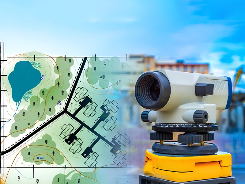
Key Applications of GIS in Urban Planning Across the UAE
Land-Use Planning and Zoning Regulations
One of the most important applications of GIS is land-use planning.
Urban planners in the UAE use GIS datasets to:
- classify land-use zones (residential, commercial, industrial, mixed-use, protected zones, etc.)
- assess land suitability for development
- manage approval and permitting processes
- plan future expansions and community developments
- prevent land-use conflicts
GIS helps visualize how development decisions affect surrounding areas, supporting balanced and sustainable urban growth.
For surveyors and developers, GIS reduces uncertainty and ensures projects align with zoning guidelines and municipal regulations.
Infrastructure & Utilities Planning
As cities expand, utility and infrastructure networks become more complex. GIS plays a vital role in planning, documenting, and managing:
- water and sewer networks
- electricity and power grids
- telecom and fiber networks
- drainage and stormwater systems
- district cooling pipelines
Using GIS, authorities and consultants can:
- map underground and above-ground utilities
- identify conflicts before construction
- plan maintenance and upgrades
- support emergency response and fault reporting
When combined with accurate survey data, GIS significantly improves asset visibility and helps reduce project risks, delays, and rework.
Transportation Planning & Smart Mobility
Transportation and mobility are key pillars of urban development in the UAE.
GIS supports:
- road network mapping and route planning
- traffic flow and congestion analysis
- public transport optimization
- pedestrian and cycling pathway planning
- parking and transport facility management
GIS also enables predictive modelling to help planners understand how population growth or new developments will impact road networks in the future.
This leads to smarter, safer, and more efficient transportation systems that support smart city objectives across the Emirates.
Environmental Impact & Sustainability Planning
Sustainability has become a priority for modern urban development. GIS is widely used in environmental monitoring and ecological planning, including:
- coastal and marine zone assessments
- vegetation and habitat mapping
- flood risk and terrain analysis
- heat-island and climate mapping
- natural resource management
GIS allows planners to:
- identify environmentally sensitive zones
- assess development impact
- support conservation initiatives
- plan eco-friendly land-use strategies
By integrating survey and environmental datasets, GIS helps promote responsible development while protecting natural landscapes.
Urban Growth Monitoring & Smart City Development
The UAE is at the forefront of smart city transformation.
GIS supports digital city initiatives by enabling:
- 3D city modelling
- urban growth monitoring
- population density analysis
- infrastructure lifecycle management
- city-wide asset mapping
When combined with reality capture and geospatial survey solutions, GIS becomes a powerful decision-support tool for:
- developers
- contractors
- municipal authorities
- master planners
- facility managers
This leads to better-planned cities, efficient infrastructure, and enhanced urban living experiences.
Disaster Risk Management & Public Safety Planning
GIS also plays a key role in safety and emergency-response planning.
Applications include:
- flood-risk mapping and terrain modelling
- emergency evacuation route planning
- disaster preparedness analysis
- hazard zone mapping
- infrastructure vulnerability assessments
Accurate geospatial data helps authorities:
- respond faster to emergencies
- minimize environmental and structural risks
- protect communities and critical assets
The Role of Accurate Survey in GIS-Driven Urban Planning
Accurate Survey supports urban development projects across the UAE by integrating:
- precise land and engineering surveys
- GIS mapping and spatial data processing
- asset and utility documentation
- 3D reality capture & laser scanning
- topographic and infrastructure surveys
By combining field survey data with advanced GIS solutions, Accurate Survey helps clients achieve:
- improved data accuracy
- better planning outcomes
- reduced rework and project delays
- enhanced asset visibility
- informed decision-making
GIS is not just a mapping tool; it is a foundation for sustainable and future-ready urban development across the UAE.
Conclusion
As UAE cities continue to expand and transform, GIS has become an essential technology for urban planning, infrastructure management, environmental protection, and smart city development.
From zoning and transportation planning to asset management and sustainability, GIS enables planners and stakeholders to visualize challenges, evaluate alternatives, and deliver better-designed cities.
With expertise in surveying, spatial data management, and geospatial technology, Accurate Survey plays a key role in supporting GIS-driven urban development across the region.