Table of Contents
ToggleWhat is a Bathymetric Survey?
A bathymetric survey is the scientific measurement and mapping of the underwater terrain. Derived from the Greek words “bathys” (deep) and “metron” (measure), bathymetry focuses on recording the depth, contours, and physical features of oceans, seas, rivers, and lakes.
Much like a topographic map represents land elevations, a bathymetric survey creates detailed charts of the seabed, supporting everything from navigation safety to large-scale engineering projects.
Applications of Bathymetric Surveys
Bathymetric surveys have wide-ranging applications that play a crucial role in the UAE’s coastal and marine development. Some key uses include:
- Port & Harbor Development: Ensuring safe vessel movement, planning dredging operations, and maintaining navigation channels.
- Marine Infrastructure Projects: Supporting the installation of pipelines, underwater cables, and offshore platforms.
- Dredging Operations: Monitoring seabed conditions and sediment levels to ensure efficiency and safety.
- Environmental Monitoring: Studying erosion, sediment transport, and marine habitats to support sustainability.
- Coastal Flood Management: Identifying flood-prone zones and assessing the impact of tides, waves, and storm surges.
- Hydrographic Charting: Updating nautical maps for accurate navigation.
With the UAE’s dynamic coastal landscape and growing maritime activity, these applications are becoming increasingly vital.
How Does a Bathymetric Survey Work?
Bathymetric surveys rely on advanced technology and precise methodologies. The process involves:
- Equipment Setup
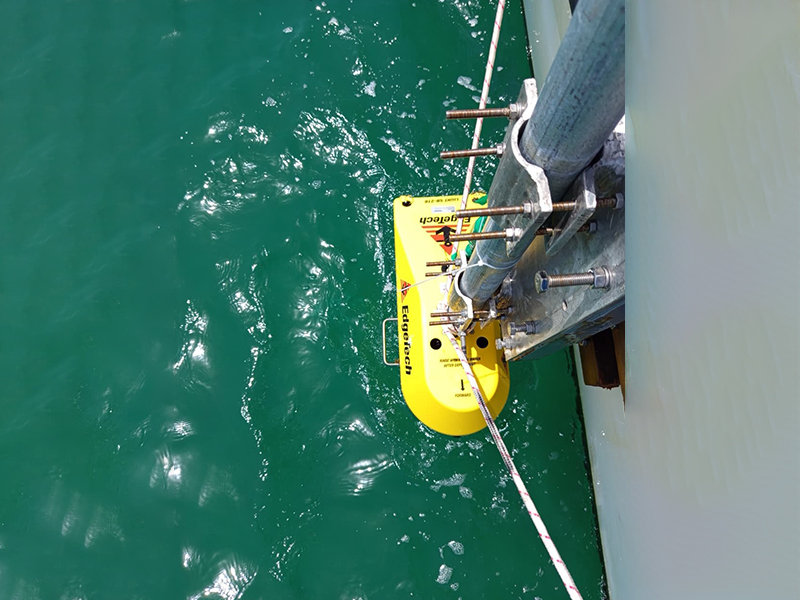
- Single-Beam Echo Sounders: Measure depths directly beneath a survey vessel.
- Multi-Beam Echo Sounders: Cover wide areas for detailed seabed profiles.
- Side-Scan Sonar: Produces detailed imagery of seabed features.
- Positioning & Navigation
- Integration with GPS and GNSS ensures accurate location referencing during surveys.
- Data Collection
- Sound waves are transmitted underwater. They reflect back from the seabed and are recorded to calculate depth.
- Data Processing
- Collected readings are processed using specialized software to create Digital Terrain Models (DTMs), contour maps, and 3D profiles.
- Final Output
- High-resolution seabed maps and charts are produced, forming a reliable basis for engineering, dredging, and navigation projects.
Advantages of Bathymetric Surveys
- Unmatched Accuracy: Provides detailed insights into underwater terrain.
- Improved Safety: Helps vessels avoid hazards and supports safe construction.
- Cost Efficiency: Enables better planning for dredging and infrastructure projects.
- Environmental Awareness: Supports studies on coastal erosion, sedimentation, and ecosystems.
- Compliance with Standards: Aligns with International Hydrographic Organization (IHO) regulations.
- Reliable Decision-Making: Supplies trusted data for governments, contractors, and developers.
Bathymetric Surveys in the UAE
The UAE’s coastline is home to major ports, reclaimed islands, and large-scale marine developments. From Dubai’s iconic Palm Jumeirah to the expansion of Abu Dhabi’s ports, accurate seabed mapping is essential. Bathymetric surveys provide the data necessary to design, build, and maintain these world-class projects.
Accurate Survey delivers end-to-end
bathymetry services
tailored to the UAE’s unique coastal environment. With modern sonar technology, experienced hydrographic professionals, and a strong commitment to accuracy, the company ensures clients receive precise and actionable seabed data.
Why Choose Accurate Survey for Bathymetric Surveys?
- Cutting-edge technology including multi-beam sonar and GNSS integration.
- Skilled hydrographic surveyors with international and UAE project experience.
- Proven record in supporting dredging, port expansion, and coastal monitoring.
- Commitment to delivering safe, accurate, and timely survey results.
A bathymetric survey is more than just a depth measurement; it is the foundation for safe navigation, sustainable marine development, and effective coastal management. In the UAE, where ambitious maritime and coastal projects continue to shape the future, Accurate Survey stands as a trusted partner for reliable bathymetric survey solutions.
Ready to map your next project with confidence?
Contact Accurate Survey UAE today to learn more about our advanced bathymetry and hydrographic services.