In an era where marine ecosystems face mounting pressures from sea-level rise and coastal erosion to habitat degradation and human-driven disturbances, precise underwater mapping is no longer a niche service. For organisations involved in marine conservation, coastal development or infrastructure near water, understanding the seafloor’s shape, depth and sediment dynamics is essential. That’s where bathymetric surveys step in, and why Accurate Survey is stepping up as a trusted partner in the United Arab Emirates.
At its core, a bathymetric survey involves the measurement and mapping of the underwater terrain: depths, slopes, features, obstacles, channels and sediments. These data enable marine scientists, coastal planners and environmental managers to make informed decisions. In this blog, we’ll explain how bathymetry supports environmental conservation, highlight emerging trends, and show how Accurate Survey brings the technology, experience and local knowledge to the task.
Key technologies and methods include:
For ocean current and sediment drift studies, Acoustic Doppler Current Profilers (ADCP) are applied, providing water column velocity profiles which support erosion mitigation and coastal resilience strategies. All collected datasets are processed using leading hydrographic software including HYPACK, SonarWiz, CODA, QINSy, and AutoCAD, ensuring accurate charting, visualization, and reporting for regulatory and conservation projects.
Table of Contents
ToggleWhat are Bathymetric Surveys?
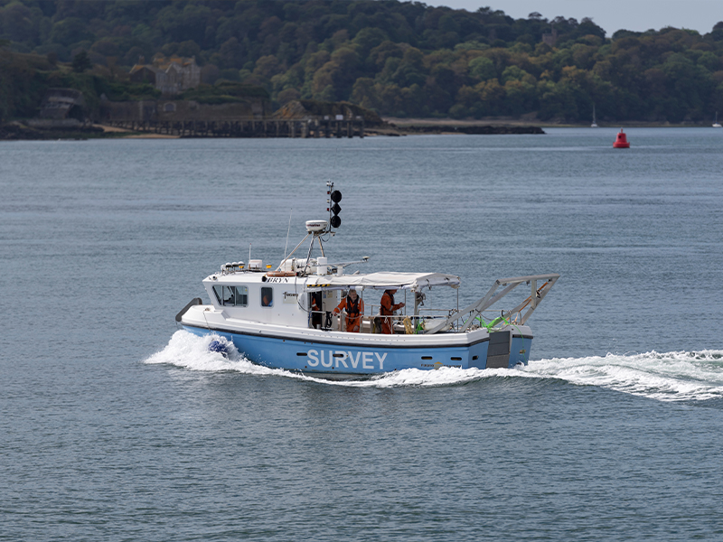
While the terms “bathymetry” and “hydrography” are often used side-by-side, bathymetry refers specifically to the mapping of underwater topography, measuring the depth of water bodies and the shape of the seabed. Accurate Survey offers a broad range of hydrographic survey services, including single-beam and multi-beam echo sounders, side-scan sonar, unmanned surface vessels (USVs), tide correction and data processing.Key technologies and methods include:
- Single-beam echo sounders (SBES) for direct depth measurement.
- Multi-beam echo sounders (MBES) for wide swath coverage of the seabed, enabling high-resolution bathymetric grids.
- Side-scan sonar for imaging the seafloor surface, detecting objects, and combining with bathymetry for comprehensive mapping.
- Unmanned Surface Vessels (USVs) or remote platforms for accessing shallow or sensitive waters.
- Tide and sound velocity corrections, necessary in dynamic coastal zones for good accuracy.
For ocean current and sediment drift studies, Acoustic Doppler Current Profilers (ADCP) are applied, providing water column velocity profiles which support erosion mitigation and coastal resilience strategies. All collected datasets are processed using leading hydrographic software including HYPACK, SonarWiz, CODA, QINSy, and AutoCAD, ensuring accurate charting, visualization, and reporting for regulatory and conservation projects.
The Role of Bathymetric Surveys in Environmental Conservation
Mapping what lies below the water surface may seem technical or ‘engineering-focused’, but its implications on environmental conservation are profound. Here are several conservation-oriented uses of bathymetry:Habitat Mapping and Marine Biodiversity Protection(h3)
Marine ecosystems such as coral reefs, mangroves, and seagrass meadows are vital to biodiversity, acting as breeding and nursery grounds for countless species. Bathymetric data helps scientists and environmental planners identify these sensitive areas, map their extents, and monitor changes over time. This information supports targeted conservation actions and ensures that development projects avoid ecologically fragile zones.Monitoring Coastal Erosion and Sediment Movement
Coastal regions in the UAE are constantly shaped by natural forces such as tides, waves, and currents. Bathymetric surveys provide valuable insights into sediment transport, seabed erosion, and deposition patterns. These data sets are essential for designing coastal protection structures and for implementing effective erosion-control measures that protect both human infrastructure and natural habitats.Supporting Environmental Impact Assessments (EIAs)(h3)
Before initiating any marine or coastal infrastructure projects, regulatory authorities require detailed environmental assessments. Bathymetric surveys form a core part of these studies by providing baseline data on underwater conditions. This information helps predict potential environmental impacts and supports sustainable decision-making in line with national and international environmental standards.Marine Spatial Planning and Protected Area Management
Effective management of marine protected areas (MPAs) relies on a precise understanding of underwater landscapes. Bathymetric mapping enables planners to define boundaries, analyze depth variations, and identify habitats that require special protection. By integrating bathymetric data with geographic information systems (GIS), authorities can develop better policies for conservation and sustainable resource use.Enhancing Climate Resilience and Coastal Adaptation
With sea-level rise and changing climate patterns posing growing challenges, bathymetric surveys are key to coastal resilience planning. Accurate seafloor data allows for the assessment of flood risks, storm surge vulnerability, and habitat stability. These insights are critical for designing adaptive solutions such as artificial reefs, mangrove restoration, and other nature-based coastal defenses.Emerging Trends in Bathymetric Surveying for Environmental Conservation
The field of bathymetry is rapidly advancing with innovations that make data collection faster, more accurate, and environmentally friendly.- Unmanned Surface Vessels (USVs): These remote-operated or autonomous vessels allow safe and efficient surveying in shallow or ecologically sensitive areas without disturbing the environment.
- High-Resolution Mapping: Modern multi-beam systems capture detailed 3D imagery of the seabed, helping detect even minor topographical changes.
- Real-Time Data Analysis: Integration of real-time monitoring and data analytics enables continuous observation of environmental shifts and seabed morphology.
- Digital Twin & 3D Modeling: Bathymetric data is increasingly used to create digital replicas of marine environments, helping predict how coastlines and seabeds will respond to environmental changes.
- Sustainable Operations: Many modern survey platforms focus on reducing fuel consumption and emissions, aligning with global sustainability goals.
Why Choose an Accurate Survey?
Accurate Survey combines advanced technology, skilled expertise, and extensive local knowledge to deliver high-quality bathymetric solutions. The company’s survey division includes hydrographic surveyors, geophysicists, environmental specialists and GIS analysts experienced in UAE coastal and offshore environments, enabling precise interpretation of seabed and sediment data for conservation and development planning. Using integrated sensor systems (MBES + IMU + GPS + SVP), Accurate Survey ensures minimal data distortion and eliminates tidal and motion-related inaccuracies, a key requirement for regulatory approval and scientific research. By integrating precise depth data, seabed imaging, and sediment analysis, Accurate Survey helps clients:- Map and monitor sensitive marine habitats.
- Detects changes in seabed conditions over time.
- Support restoration and conservation initiatives.
- Provide reliable data for environmental compliance and regulatory reporting.
Real-World Applications in the UAE
In the UAE, bathymetric surveys are increasingly vital across various conservation and development contexts, such as:- Mangrove and Seagrass Restoration Projects: Supporting reforestation and habitat recovery through detailed seabed mapping.
- Coastal Erosion Studies: Helping authorities plan shoreline stabilization and protection structures.
- Marine Protected Area Management: Assisting in delineating and monitoring protected marine zones.
- Infrastructure Planning: Ensuring that offshore and coastal construction projects are developed responsibly with minimal environmental impact.
- Climate Change Studies: Contributing to the understanding of how marine and coastal ecosystems respond to sea-level rise and extreme weather events.